Tottenham - Tottenham Ronan
Airport details
| Country | Canada |
| State | Ontario |
| Region | CY |
| Airspace | Toronto Ctr |
| Municipality | New Tecumseth |
| Elevation | 823ft (251m) |
| Timezone | GMT -5 |
| Coordinates | 44.04222, -79.84639 |
| Magnetic var | |
| Type | land |
| Available since | X-Plane v10.40 |
| ICAO code | XC008F |
| IATA code | n/a |
| FAA code | n/a |
Communication
Nearby Points of Interest:
Kinghorn Methodist Episcopal Cemetery
-Shift
-Newmarket Railway Station
-Old Newmarket Town Hall and Courthouse
-Queensville Radial Station
-Richmond Hill railway station
-David Dunlap Observatory
-Markham Civic Centre
-Government of Canada Building
-Sutton radial station
-Lebovic Centre for Arts & Entertainment – Nineteen on the Park
-The Briars
-Markham Village Town Hall
-Runnymede Theatre
-Deer Park United Church
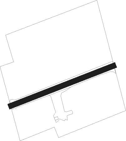
Runway info
| Runway 07 / 25 | ||
| length | 621m (2037ft) | |
| bearing | 78° / 258° | |
| width | 30m (100ft) | |
| surface | grass | |
Nearby beacons
| code | identifier | dist | bearing | frequency |
|---|---|---|---|---|
| YMS | MANS (MANSFIELD) VOR/DME | 14.2 | 289° | 114.50 |
| ZTO | WOODHILL (TORONTO) NDB | 19.2 | 155° | 403 |
| KZ | BUTTONVILLE NDB | 23.2 | 102° | 248 |
| YTP | PEARSON (TORONTO) VOR/DME | 23.6 | 154° | 116.55 |
| YYZ | TORONTO VOR/DME | 24.8 | 151° | 112.15 |
| ZYZ | QUEENSWAY (TORONTO) NDB | 28.4 | 145° | 368 |
| YSO | DME | 31.3 | 74° | 117.35 |
| YEE | MIDLAND VOR/DME | 32.4 | 6° | 112.80 |
| TZ | GIBRALTAR POINT NDB | 32.6 | 133° | 257 |
| ZKF | WELLINGTON (KITCHENER) NDB | 38.1 | 219° | 335 |
| OO | OSHAWA NDB | 41.5 | 97° | 391 |
| WT | (KITCHENER) DME | 41.9 | 222° | 115 |
| YO | DME-ILS | 42.1 | 97° | 111.35 |
| ZHA | ANCASTER (HAMILTON) NDB | 51.3 | 192° | 397 |
| ZHM | BINBROOK (HAMILTON) NDB | 53.9 | 177° | 266 |
| HM | HAMILTON NDB | 55.7 | 190° | 221 |
| SN | ST CATHARINES NDB | 59.5 | 147° | 408 |
| FD | BRANTFORD NDB | 63.2 | 210° | 207 |
| IAG | NIAGARA FALLS TACAN | 67.8 | 136° | 111 |
Disclaimer
The information on this website is not for real aviation. Use this data with the X-Plane flight simulator only! Data taken with kind consent from X-Plane 12 source code and data files. Content is subject to change without notice.