Gabès - Gabes
Airport details
| Country | Tunisia |
| State | Gabès |
| Region | DT |
| Airspace | Tunis Ctr |
| Municipality | شانشو |
| Elevation | 410ft (125m) |
| Timezone | GMT +1 |
| Coordinates | 33.73486, 9.91510 |
| Magnetic var | |
| Type | land |
| Available since | X-Plane v10.40 |
| ICAO code | XDT0001 |
| IATA code | GAE |
| FAA code | n/a |
Communication
Nearby Points of Interest:
Gabes Oasis
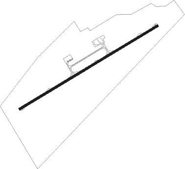
Runway info
| Runway 06 / 24 | ||
| length | 2997m (9833ft) | |
| bearing | 67° / 247° | |
| width | 45m (148ft) | |
| surface | asphalt | |
| blast zone | 70m (230ft) / 70m (230ft) | |
Nearby beacons
| code | identifier | dist | bearing | frequency |
|---|---|---|---|---|
| GAB | GABES VOR/DME | 0.3 | 118° | 115.40 |
| JBA | DJERBA VOR/DME | 43.5 | 81° | 112.20 |
| SFX | SFAX VOR/DME | 70.3 | 38° | 114 |
Disclaimer
The information on this website is not for real aviation. Use this data with the X-Plane flight simulator only! Data taken with kind consent from X-Plane 12 source code and data files. Content is subject to change without notice.