Bobzin
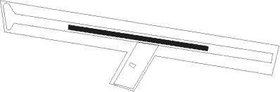
Airport details
| Country | Germany |
| State | Mecklenburg-Vorpommern |
| Region | |
| Airspace | Bremen Ctr |
| Municipality | Bobzin |
| Elevation | 146ft (45m) |
| Timezone | GMT +1 |
| Coordinates | 53.48611, 11.16833 |
| Magnetic var | |
| Type | land |
| Available since | X-Plane v11.40 |
| ICAO code | XED000V |
| IATA code | n/a |
| FAA code | n/a |
Communication
| Bobzin Bobzin Info | 121.010 |
Nearby Points of Interest:
Church in Gammelin
-Church in Körchow
-Herrenhaus Zühr
-Church in Döbbersen
-Dorfkirche Vellahn
-Herrenhaus Tüschow
-Mecklenburg-Vorpommern state library
-Offizierskasino Schwerin
-Staatskanzlei Mecklenburg-Vorpommern
-Residenzensemble Schwerin
-Volksschwimmhalle Lankow
-Kurhotel Schwerin-Zippendorf
-Reichsbahndirektion Schwerin
-Town hall (Schwerin)
-Neustädtisches Palais
-Neustädtisches Rathaus
-August-Bebel-Straße 29
-Rathaus Gadebusch
-Gadebusch railway station
-Friedhof Sachsenberg
-Funkamt Wöbbelin
-Herrenhaus Schönfeld
-Helenen-Paulownen-Mausoleum
-Wöbbelin concentration camp
-Ludwigsluster Kanal
Nearby beacons
| code | identifier | dist | bearing | frequency |
|---|---|---|---|---|
| PAH | SCHWERIN-PARCHIM NDB | 18.6 | 100° | 315 |
| PMD | DME | 22.3 | 96° | 117.50 |
| LYE | LUEBECK NDB | 25.3 | 304° | 394 |
| PI | SCHWERIN-PARCHIM NDB | 26.4 | 92° | 333 |
| BKD | BRUENKENDORF VOR/DME | 30.3 | 140° | 117.70 |
| HAM | HAMBURG VORTAC | 36.3 | 282° | 113.10 |
| FSB | FASSBERG NDB | 49.1 | 240° | 284 |
Disclaimer
The information on this website is not for real aviation. Use this data with the X-Plane flight simulator only! Data taken with kind consent from X-Plane 12 source code and data files. Content is subject to change without notice.