Brakel - Ul Brakel
Airport details
| Country | Germany |
| State | North Rhine-Westphalia |
| Region | |
| Airspace | Bremen Ctr |
| Municipality | Brakel |
| Elevation | 565ft (172m) |
| Timezone | GMT +1 |
| Coordinates | 51.73867, 9.20046 |
| Magnetic var | |
| Type | land |
| Available since | X-Plane v10.40 |
| ICAO code | XED0015 |
| IATA code | n/a |
| FAA code | n/a |
Communication
Nearby Points of Interest:
St. Mariä Himmelfahrt (Bruchhausen)
-Rommenhöller-Denkmal
-Jewish cemetery, Vörden, Marienmünster
-Rathaus Nieheim
-Mariä Himmelfahrt
-Schloss Amelunxen
-St. Jakobus d. Ä. und Christophorus
-Gut Grevenburg
-Felsenkeller (Höxter)
-Adelshof Heisterman von Ziehlberg
-Obermühle
-Amtsgericht Höxter
-Rathaus Höxter
-Mariä Verkündigung
-Schloss Niesen
-Dreizehnlindenhaus
-Dreizehnlinden-Kreuz
-Burg Peckelsheim
-Bahnhof Buke
-Bauernburg Ottenhausen
-Haus Suchier
-Rathaus Bad Karlshafen
-Invalidenhaus
-Jüdischer Friedhof
-Amtsgericht Horn
Runway info
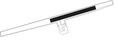
| Runway 08 / 26 | ||
| length | 295m (968ft) | |
| bearing | 82° / 262° | |
| width | 25m (82ft) | |
| surface | grass | |
Nearby beacons
| code | identifier | dist | bearing | frequency |
|---|---|---|---|---|
| WRB | WARBURG VOR/DME | 14.3 | 201° | 113.70 |
| DKS | DME-ILS | 20.5 | 147° | 111.50 |
| PAD | PADERBORN-LIPPSTADT NDB | 22 | 258° | 354 |
| PAD | DME-ILS | 23 | 258° | 108.50 |
| BYC | BUECKEBURG NDB | 33.4 | 349° | 368 |
| DLE | LEINE VOR/DME | 39.7 | 53° | 115.20 |
| SAS | SARSTEDT VOR/DME | 39.8 | 53° | 114.45 |
| FTZ | FRITZLAR NDB | 40.1 | 162° | 468 |
| OSB | OSNABRUCK TACAN | 43.7 | 297° | 108.35 |
| OSN | OSNABRUECK VOR | 43.7 | 297° | 114.30 |
| WUN | WUNSTORF TACAN | 43.8 | 18° | 114.85 |
| HW | HANNOVER NDB | 45.6 | 25° | 358 |
| HBD | DME | 46.2 | 33° | 116.90 |
| HAD | DME | 47.4 | 34° | 113.95 |
| HA | HANNOVER NDB | 48.9 | 40° | 320 |
| NIE | NIENBURG VOR | 53.6 | 11° | 116.50 |
| DP | DIEPHOLZ NDB | 58.1 | 319° | 325 |
| CEL | CELLE NDB | 59.5 | 44° | 311 |
Disclaimer
The information on this website is not for real aviation. Use this data with the X-Plane flight simulator only! Data taken with kind consent from X-Plane 12 source code and data files. Content is subject to change without notice.