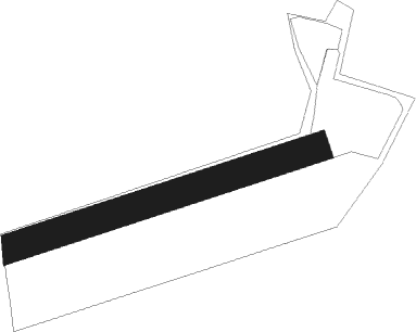
Walsrode - Walsrode Luisenhoehe
Airport details
| Country | Germany |
| State | Lower Saxony |
| Region | |
| Airspace | Bremen Ctr |
| Municipality | Walsrode |
| Elevation | 153ft (47m) |
| Timezone | GMT +1 |
| Coordinates | 52.88765, 9.59594 |
| Magnetic var | |
| Type | land |
| Available since | X-Plane v10.40 |
| ICAO code | XED0016 |
| IATA code | n/a |
| FAA code | n/a |
Communication
| Walsrode Luisenhoehe WALSRODE INFO | 122.135 |
Nearby beacons
| code | identifier | dist | bearing | frequency |
|---|---|---|---|---|
| NIE | NIENBURG VOR | 17.7 | 221° | 116.50 |
| FSB | FASSBERG NDB | 21.5 | 87° | 284 |
| CEL | CELLE NDB | 23.8 | 125° | 311 |
| HW | HANNOVER NDB | 25.2 | 187° | 358 |
| HAD | DME | 25.4 | 167° | 113.95 |
| HBD | DME | 26 | 172° | 116.90 |
| HA | HANNOVER NDB | 26.5 | 154° | 320 |
| HIG | BREMEN NDB | 26.6 | 283° | 318 |
| WUN | WUNSTORF TACAN | 26.6 | 201° | 114.85 |
| BND | DME | 30.8 | 281° | 113.65 |
| BMN | BREMEN VOR/DME | 31.6 | 281° | 117.45 |
| WSN | WESER NDB | 37.9 | 303° | 378 |
| DLE | LEINE VOR/DME | 39.6 | 156° | 115.20 |
| SAS | SARSTEDT VOR/DME | 39.6 | 156° | 114.45 |
| BYC | BUECKEBURG NDB | 40.2 | 220° | 368 |
| ALF | DME | 47.1 | 28° | 115.80 |
| HAM | HAMBURG VORTAC | 52.6 | 37° | 113.10 |
| NDO | NORDHOLZ NDB | 60.8 | 319° | 372 |
| NDO | NORDHOLZ TACAN | 62.8 | 313° | 117.10 |
Disclaimer
The information on this website is not for real aviation. Use this data with the X-Plane flight simulator only! Data taken with kind consent from X-Plane 12 source code and data files. Content is subject to change without notice.
