Weilerswist
Airport details
| Country | Germany |
| State | North Rhine-Westphalia |
| Region | |
| Airspace | Langen Ctr |
| Municipality | Weilerswist |
| Elevation | 444ft (135m) |
| Timezone | GMT +1 |
| Coordinates | 50.71731, 6.84810 |
| Magnetic var | |
| Type | land |
| Available since | X-Plane v10.40 |
| ICAO code | XED001Z |
| IATA code | n/a |
| FAA code | n/a |
Communication
| Weilerswist Weilerswist-INFO | 120.080 |
Nearby Points of Interest:
Synagogue Lommersum
-Burg Bodenheim
-Wasserburg Redinghoven
-Prämonstratenserinnenstift, vorher Augustinerinnenkloster Marienstern, Essig (Kloster Maria Stern)
-Schloss Rösberg
-Bliesheimer Mühle
-Cemetery Chapel
-Jüdischer Friedhof Walberberg
-Apolloniakapelle
-Jüdischer Friedhof
-Oebelsmühle
-Husarenquartier
-Parkanlagen Schloss Lechenich
-Jewish cemetery, Alfter
-Hertersplatz 13
-Hubertusstraße 2
-Amtsgericht Brühl
-St.-Anna-Kapelle
-Augustusburg and Falkenlust Palaces
-Hallenburg Disternich
-Palmersdorfer Hof
-Antoniuskapelle
-Godorfer Burg
-Müddersheimer Mühle
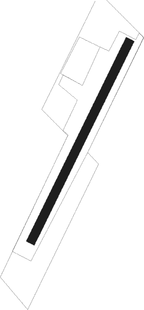
Runway info
| Runway 04 / 22 | ||
| length | 500m (1640ft) | |
| bearing | 43° / 223° | |
| width | 20m (66ft) | |
| surface | grass | |
Nearby beacons
| code | identifier | dist | bearing | frequency |
|---|---|---|---|---|
| WNN | DME | 9.8 | 303° | 109.85 |
| NVO | NOERVENICH VORTAC | 10.2 | 296° | 116.20 |
| KBO | COLOGNE-BONN VOR/DME | 14.2 | 64° | 112.15 |
| LJ | COLOGNE-BONN NDB | 14.9 | 46° | 365 |
| LV | COLOGNE-BONN NDB | 15.7 | 78° | 327 |
| LW | COLOGNE-BONN NDB | 18.8 | 66° | 300 |
| WYP | WIPPER VOR | 25.7 | 53° | 109.60 |
| COL | COLA VOR/DME | 28.6 | 85° | 108.80 |
| DY | DUESSELDORF NDB | 31.9 | 339° | 284 |
| BUE | BUECHEL TACAN | 33.4 | 158° | 117.10 |
| GIX | GEILENKIRCHEN TACAN | 33.8 | 287° | 108.10 |
| MHD | DME | 33.8 | 325° | 112.50 |
| MHV | MOENCHENGLADBACH VOR | 34 | 325° | 109.80 |
| DUS | DUESSELDORF VOR/DME | 34.1 | 351° | 115.15 |
| MAS | MAASTRICHT VOR/DME | 36.9 | 286° | 108.60 |
| LI | DUESSELDORF NDB | 37.8 | 4° | 417 |
| SLV | SPA NDB | 38.4 | 256° | 386 |
| BAM | BARMEN VOR/DME | 38.7 | 28° | 114 |
| NW | MAASTRICHT NDB | 40.9 | 287° | 373 |
| LMA | LIMA NDB | 42.8 | 325° | 311 |
| SPA | SPANGDAHLEM TACAN | 44.7 | 192° | 109.50 |
| HAN | HAHN NDB | 48.1 | 150° | 376 |
| FHH | DME | 49.1 | 152° | 117.35 |
| BOT | BOTTROP NDB | 52.5 | 11° | 406 |
| DOR | WICKEDE (DORTMUND) VOR/DME | 56.7 | 44° | 108.65 |
| DWI | DORTMUND-WICKEDE NDB | 56.9 | 44° | 357 |
| DIK | DIEKIRCH NDB | 58.3 | 220° | 307 |
| LAA | NIEDERRHEIN NDB | 58.8 | 323° | 352 |
| NID | DME | 59.3 | 321° | 115.50 |
Disclaimer
The information on this website is not for real aviation. Use this data with the X-Plane flight simulator only! Data taken with kind consent from X-Plane 12 source code and data files. Content is subject to change without notice.