Salzgitter - Am Salzgittersee
Airport details
| Country | Germany |
| State | Lower Saxony |
| Region | |
| Airspace | Bremen Ctr |
| Municipality | Salzgitter |
| Elevation | 254ft (77m) |
| Timezone | GMT +1 |
| Coordinates | 52.17013, 10.31594 |
| Magnetic var | |
| Type | land |
| Available since | X-Plane v11.55 |
| ICAO code | XED0020 |
| IATA code | n/a |
| FAA code | n/a |
Communication
| Am Salzgittersee Lebenstedt Info | 132.830 |
Nearby Points of Interest:
St. Paulus
-Gebläsehalle
-Baudenkmalensemble Auguststadt
-Rübenschloß
-Kleines Schloss
-Baudenkmalensemble Freiheit
-Christuskirche in Gitter am Berge
-Kanzlerhaus
-Kirche Klein Mahner
-Haus zur Hanse
-Ritter St. Georg, Braunschweig
-Alter Bahnhof
-Steinstraße 3
-Portal An der Martinikirche 1
-Rüninger Zollhaus
-Autorshof
-Marienbrunnen (Braunschweig)
-Haus zu den 7 Türmen
-Haus Anker
-Villa Salve Hospes
-Kohlmarktbrunnen
-Haus zur Sonne
-Garnison-Schule
-Haus Leuenturm
-Villa Rimpau
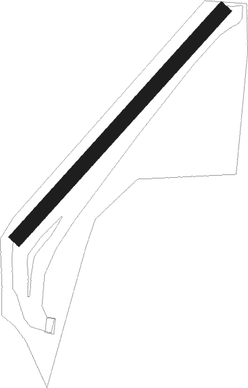
Runway info
| Runway 04 / 22 | ||
| length | 726m (2382ft) | |
| bearing | 60° / 240° | |
| width | 34m (110ft) | |
| surface | grass | |
Nearby beacons
| code | identifier | dist | bearing | frequency |
|---|---|---|---|---|
| BRU | BRAUNSCHWEIG-WOLFSBURG NDB | 14 | 62° | 427 |
| DLE | LEINE VOR/DME | 16.6 | 281° | 115.20 |
| SAS | SARSTEDT VOR/DME | 16.6 | 281° | 114.45 |
| HLZ | HEHLINGEN VOR/DME | 21 | 68° | 117.30 |
| HA | HANNOVER NDB | 25.7 | 300° | 320 |
| CEL | CELLE NDB | 27.2 | 326° | 311 |
| HAD | DME | 28.9 | 296° | 113.95 |
| HBD | DME | 29.5 | 293° | 116.90 |
| HW | HANNOVER NDB | 33.4 | 291° | 358 |
| WUN | WUNSTORF TACAN | 36.7 | 288° | 114.85 |
| NIE | NIENBURG VOR | 44.1 | 296° | 116.50 |
| FSB | FASSBERG NDB | 45 | 350° | 284 |
| DKS | DME-ILS | 56.2 | 231° | 111.50 |
Disclaimer
The information on this website is not for real aviation. Use this data with the X-Plane flight simulator only! Data taken with kind consent from X-Plane 12 source code and data files. Content is subject to change without notice.