Zetel - Bohlenbergerfeld
Airport details
| Country | Germany |
| State | Lower Saxony |
| Region | |
| Airspace | Bremen Ctr |
| Municipality | Zetel |
| Elevation | 25ft (8m) |
| Timezone | GMT +1 |
| Coordinates | 53.41828, 7.90451 |
| Magnetic var | |
| Type | land |
| Available since | X-Plane v11.51r1 |
| ICAO code | XED002B |
| IATA code | n/a |
| FAA code | n/a |
Communication
Nearby Points of Interest:
Woltzetener Kirche
-Lutherische Kirche
-Holy Cross Church
-Ostgroßefehner Kirche
-St. Florian
-St. Stephanuskirche
-Bavariahaus
-Strandhalle Wilhelmshaven
-Mansinger Burgplatz
-Holtrop Church
-Liudgerikirche
-Andreaskirche
-Altfunnixsieler Mühle
-Wasserwerk Aurich
-St.-Ludgerus-Kirche
-Landschaftshaus
-Evertssches Haus
-Pingelhus
-Teehäuschen
-Staatshochbauamt
-Friedhofswärterhaus
-Denkmal für die Gefallenen des Deutsch-Französischen Krieges 1870/71 (Aurich)
-Aurich railway station
-Julianenburg
-St. Cosmas und Damian (Barßel)
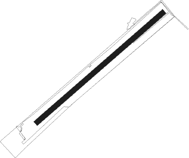
Runway info
| Runway 05 / 23 | ||
| length | 923m (3028ft) | |
| bearing | 66° / 246° | |
| width | 30m (98ft) | |
| surface | grass | |
Nearby beacons
| code | identifier | dist | bearing | frequency |
|---|---|---|---|---|
| WTM | WITTMUNDHAFEN TACAN | 10.3 | 307° | 113.50 |
| NDO | NORDHOLZ TACAN | 34 | 65° | 117.10 |
| WSN | WESER NDB | 35 | 94° | 378 |
| BMN | BREMEN VOR/DME | 38 | 113° | 117.45 |
| BND | DME | 38.7 | 113° | 113.65 |
| NDO | NORDHOLZ NDB | 38.9 | 68° | 372 |
| DHE | HELGOLAND VOR/DME | 46 | 0° | 116.30 |
| DP | DIEPHOLZ NDB | 53.4 | 146° | 325 |
Disclaimer
The information on this website is not for real aviation. Use this data with the X-Plane flight simulator only! Data taken with kind consent from X-Plane 12 source code and data files. Content is subject to change without notice.