Frankendorf Ul
Airport details
| Country | Germany |
| State | Bavaria |
| Region | |
| Airspace | Munich Ctr |
| Municipality | Buttenheim |
| Elevation | 513ft (156m) |
| Timezone | GMT +1 |
| Coordinates | 49.83600, 11.08900 |
| Magnetic var | |
| Type | land |
| Available since | X-Plane v10.40 |
| ICAO code | XED002R |
| IATA code | n/a |
| FAA code | n/a |
Communication
Nearby Points of Interest:
Burgstall Ketschenstein
-Turmhügel Obersenftenberg
-Burgstall Niedersenftenberg
-Turmhügel Zoggendorf
-Schulgebäude
-Judenschule (Hirschaid)
-Burgstall Hoher Stein (Reckendorf)
-Rüssenbach Castle
-Kirche
-Amtsgericht
-Rathaus in Ebermannstadt
-Adelsburg
-Rathaus
-Torwache
-Pfalz
-Wolkenstein Castle
-Ottonianum (Bamberg)
-Burgstall Thüngfelderstein
-Dr.-Remeis-Sternwarte
-Schleusenwärterhaus Schleuse 100 in Bamberg
-Bamberg
-Aufseesianum
-Taharahaus
-Wohnhaus
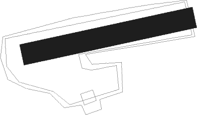
Runway info
| Runway 08 / 26 | ||
| length | 144m (472ft) | |
| bearing | 85° / 265° | |
| width | 19m (63ft) | |
| surface | grass | |
Nearby beacons
| code | identifier | dist | bearing | frequency |
|---|---|---|---|---|
| ERL | ERLANGEN VOR/DME | 11.1 | 161° | 114.90 |
| NGD | DME | 20.1 | 182° | 113.10 |
| NUB | NUERNBERG VOR/DME | 20.1 | 189° | 115.75 |
| RTB | ROETHENBACH NDB | 22.1 | 155° | 415 |
| BAY | BAYREUTH VOR | 22.9 | 75° | 110.60 |
| GRF | GRAFENWOHR TACAN | 34 | 100° | 111.80 |
| GRW | GRAFENWOHR NDB | 34.1 | 99° | 405 |
| ILM | ILLESHEIM NDB | 34.9 | 243° | 488 |
| ANS | ANSBACH NDB | 36.3 | 221° | 452 |
| HFX | HOHENFELS NDB | 47.7 | 129° | 286 |
| DKB | DINKELSBUEHL VORTAC | 53.2 | 231° | 117.80 |
Disclaimer
The information on this website is not for real aviation. Use this data with the X-Plane flight simulator only! Data taken with kind consent from X-Plane 12 source code and data files. Content is subject to change without notice.