Metelen - Metelen Ul
Airport details
| Country | Germany |
| State | North Rhine-Westphalia |
| Region | |
| Airspace | Langen Ctr |
| Municipality | Metelen |
| Elevation | 160ft (49m) |
| Timezone | GMT +1 |
| Coordinates | 52.15923, 7.24127 |
| Magnetic var | |
| Type | land |
| Available since | X-Plane v11.55 |
| ICAO code | XED0033 |
| IATA code | n/a |
| FAA code | n/a |
Communication
| Metelen UL Metelen Info | 120.000 |
Nearby Points of Interest:
Jüdischer Friedhof (Metelen)
-Haus Markt 16
-Konzerthalle im Steinfurter Bagno
-Burg Nienborg
-St. Antonius Abt
-Aloysiuskapelle (Borghorst)
-St. Arnold railway station
-Evangelisch-reformierte Kirche Ohne
-St. Anna
-Amtsgericht Ahaus
-Old Saint John the Baptist Church
-Saline Gottesgabe
-Kalkwerk Hollekamp
-Klooster Dolphia
-De Hooge Boekel
-Pforte Gerleve
-Smalenbroek
-Watertoren in Enschede, Hoog & Droog
-Elderinkshuis, Enschede
-Town hall
-Oldenzaalsestraat 125, Enschede
-Doopsgezinde kerk, Enschede
-Korte Hengelosestraat 1, Enschede
-watertoren Enschede Janninktoren
-Haus Darup
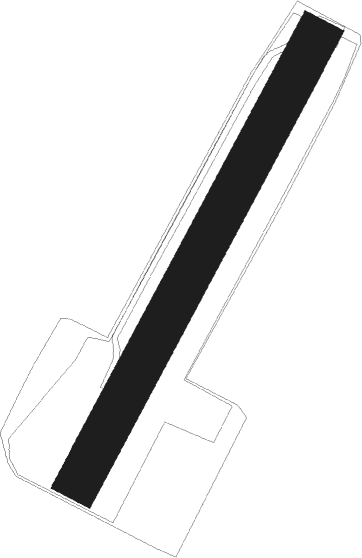
Runway info
| Runway 03 / 21 | ||
| length | 285m (935ft) | |
| bearing | 46° / 226° | |
| width | 25m (82ft) | |
| surface | grass | |
Nearby beacons
| code | identifier | dist | bearing | frequency |
|---|---|---|---|---|
| MOD | DME | 16.4 | 93° | 114.05 |
| RKN | DME | 17.6 | 267° | 116.80 |
| MYN | MUENSTER/OSNABRUECK NDB | 20.5 | 90° | 371 |
| HMM | HAMM VOR/DME | 25 | 123° | 115.65 |
| BOT | BOTTROP NDB | 35.3 | 201° | 406 |
| DOR | WICKEDE (DORTMUND) VOR/DME | 40.7 | 148° | 108.65 |
| DWI | DORTMUND-WICKEDE NDB | 40.7 | 148° | 357 |
| BAM | BARMEN VOR/DME | 49.9 | 184° | 114 |
| LI | DUESSELDORF NDB | 50.4 | 203° | 417 |
| DUS | DUESSELDORF VOR/DME | 55.6 | 209° | 115.15 |
| LMA | LIMA NDB | 56.8 | 227° | 311 |
| DY | DUESSELDORF NDB | 59.6 | 212° | 284 |
| MHV | MOENCHENGLADBACH VOR | 62 | 219° | 109.80 |
| MHD | DME | 62.1 | 219° | 112.50 |
| GMH | GERMINGHAUSEN VOR/DME | 64.1 | 147° | 115.40 |
Disclaimer
The information on this website is not for real aviation. Use this data with the X-Plane flight simulator only! Data taken with kind consent from X-Plane 12 source code and data files. Content is subject to change without notice.