Kleinfurra - Sondershausen / Hain Ul
Airport details
| Country | Germany |
| State | Thuringia |
| Region | |
| Airspace | Munich Ctr |
| Municipality | Kleinfurra |
| Elevation | 869ft (265m) |
| Timezone | GMT +1 |
| Coordinates | 51.43755, 10.77467 |
| Magnetic var | |
| Type | land |
| Available since | X-Plane v10.40 |
| ICAO code | XED003J |
| IATA code | n/a |
| FAA code | n/a |
Communication
| Sondershausen / Hain UL Hain | 123.425 |
Nearby Points of Interest:
St. Laurentius
-Schloss Kleinwerther
-Church in Pustleben
-Kirche Elende
-Church in Großberndten
-St. Spiritus
-Protestant Church Hohenebra
-St. Andreas
-St. Nicolai
-Menhir von Berga
-St. Peter and Paul (Holzthaleben)
-St. Bartolomäus (Ebeleben)
-St. Wigberti
-St. Margaretha
-Kirche St.Martini
-Brauerei Kelbra
-Jagdschloss Walkenried
-Chalet Waldfrieden
-Rathaus Stolberg (Harz)
-St. Michael (Kirchengel)
-Buhla village church
-Protestant church (Holzengel)
-Menhir von Feldengel
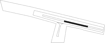
Runway info
| Runway 10 / 28 | ||
| length | 202m (663ft) | |
| bearing | 101° / 281° | |
| width | 11m (36ft) | |
| surface | asphalt | |
Nearby beacons
| code | identifier | dist | bearing | frequency |
|---|---|---|---|---|
| EFD | DME | 28.1 | 158° | 112.05 |
| GOT | GOTEM VOR/DME | 31.3 | 97° | 115.25 |
| ERF | ERFURT VOR/DME | 34 | 136° | 113.85 |
| CB | COCHSTEDT NDB | 35.7 | 58° | 344 |
| BRU | BRAUNSCHWEIG-WOLFSBURG NDB | 53.4 | 349° | 427 |
| HLZ | HEHLINGEN VOR/DME | 55.6 | 1° | 117.30 |
| DLE | LEINE VOR/DME | 58.9 | 312° | 115.20 |
| SAS | SARSTEDT VOR/DME | 58.9 | 312° | 114.45 |
Disclaimer
The information on this website is not for real aviation. Use this data with the X-Plane flight simulator only! Data taken with kind consent from X-Plane 12 source code and data files. Content is subject to change without notice.