Gössenheim - Goessenheim Ul
Airport details
| Country | Germany |
| State | Bavaria |
| Region | |
| Airspace | Langen Ctr |
| Municipality | Gössenheim |
| Elevation | 745ft (227m) |
| Timezone | GMT +1 |
| Coordinates | 50.02881, 9.77001 |
| Magnetic var | |
| Type | land |
| Available since | X-Plane v10.40 |
| ICAO code | XED003K |
| IATA code | n/a |
| FAA code | n/a |
Communication
| Goessenheim UL Goessenheim Start | 122.715 |
Nearby Points of Interest:
Burgstall Slorburg
-Filialkirche
-Hauptstraße 7
-Hauptstraße 9/11
-Pfarrkirche
-Rathaus
-Bürgerzentrum
-Tretstein waterfall
-Pfarrhaus
-Amtsgericht
-Evangelische Kirche (Waizenbach)
-Mönchsturm (Hammelburg)
-Schloss Rodenbach
-Pfarrhof
-Maria Sondheim
-Burg Arnstein
-Alte Burg
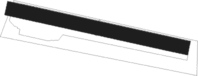
Runway info
| Runway 10 / 28 | ||
| length | 365m (1198ft) | |
| bearing | 101° / 281° | |
| width | 29m (95ft) | |
| surface | grass | |
Nearby beacons
| code | identifier | dist | bearing | frequency |
|---|---|---|---|---|
| CHA | CHARLIE VOR/DME | 28.9 | 262° | 115.35 |
| GED | GEDERN VORTAC | 30.4 | 306° | 110.80 |
| FUL | FULDA VOR/DME | 34.6 | 341° | 112.10 |
| MTR | METRO VOR | 38.4 | 285° | 110 |
| NDD | DME-ILS | 38.8 | 163° | 108.70 |
| NSN | NIEDERSTETTEN NDB | 38.8 | 163° | 311 |
| ILM | ILLESHEIM NDB | 41.1 | 132° | 488 |
| ANS | ANSBACH NDB | 54.6 | 130° | 452 |
| SHD | HALL DME | 54.7 | 179° | 108.05 |
| DKB | DINKELSBUEHL VORTAC | 56.2 | 152° | 117.80 |
Disclaimer
The information on this website is not for real aviation. Use this data with the X-Plane flight simulator only! Data taken with kind consent from X-Plane 12 source code and data files. Content is subject to change without notice.