Bühlertann - Fischachtal
Airport details
| Country | Germany |
| State | Baden-Württemberg |
| Region | |
| Airspace | Langen Ctr |
| Municipality | Obersontheim |
| Elevation | 1263ft (385m) |
| Timezone | GMT +1 |
| Coordinates | 49.03781, 9.86909 |
| Magnetic var | |
| Type | land |
| Available since | X-Plane v10.40 |
| ICAO code | XED003L |
| IATA code | n/a |
| FAA code | n/a |
Communication
| Fischachtal Mittelfischach Info | 123.425 |
Nearby Points of Interest:
Herrenmühle (Obersontheim)
-St. Martin
-Schloss Tullau
-Kreissparkasse (Schwäbisch Hall)
-Am Markt 9 (Schwäbisch Hall)
-Heilig-Geist-Spital
-Jüdischer Friedhof Crailsheim
-Castra of Murrhardt
-Kloster Murrhardt
-Kirche Lindach
-Oberes Schloss
-St. Nemesius
-Villa Franck
-Rehnenhofkapelle
-Spital zum hl. Geist Schwäbisch Gmünd
-Rechbergsche Scheuer
-Grät Schwäbisch Gmünd
-Rathaus Schwäbisch Gmünd
-Kapitelshaus Schwäbisch Gmünd
-Stadtarchiv Schwäbisch Gmünd
-Jupitergigantensäule von Walheim
-Alte PH
-Altes Schulhaus Bargau
-Haltepunkt Schwäbisch Gmünd Süd
-Bildstock mit Pietà (Amrichshausen)
Runway info
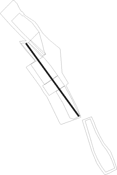
| Runway 15 / 33 | ||
| length | 592m (1942ft) | |
| bearing | 137° / 317° | |
| width | 9m (31ft) | |
| surface | grass | |
Nearby beacons
| code | identifier | dist | bearing | frequency |
|---|---|---|---|---|
| SHD | HALL DME | 5.9 | 311° | 108.05 |
| DKB | DINKELSBUEHL VORTAC | 15.8 | 74° | 117.80 |
| NDD | DME-ILS | 21.6 | 14° | 108.70 |
| NSN | NIEDERSTETTEN NDB | 21.7 | 15° | 311 |
| LBU | LUBURG VOR/DME | 22.1 | 257° | 109.20 |
| STG | STUTTGART VOR/DME | 31.7 | 241° | 116.85 |
| ILM | ILLESHEIM NDB | 33 | 50° | 488 |
| SGD | DME | 33 | 242° | 115.45 |
| ANS | ANSBACH NDB | 34 | 70° | 452 |
| TGO | TANGO TACAN | 34.8 | 235° | 112.50 |
| LUP | LAUPHEIM NDB | 49.2 | 177° | 407 |
| CHA | CHARLIE VOR/DME | 62.1 | 317° | 115.35 |
| LCH | LECHFELD TACAN | 64.3 | 131° | 108.80 |
Disclaimer
The information on this website is not for real aviation. Use this data with the X-Plane flight simulator only! Data taken with kind consent from X-Plane 12 source code and data files. Content is subject to change without notice.