Besitz - Teldau - Amholz Ul
Airport details
| Country | Germany |
| State | Mecklenburg-Vorpommern |
| Region | |
| Airspace | Bremen Ctr |
| Municipality | Teldau |
| Elevation | 25ft (8m) |
| Timezone | GMT +1 |
| Coordinates | 53.32828, 10.83298 |
| Magnetic var | |
| Type | land |
| Available since | X-Plane v10.40 |
| ICAO code | XED003N |
| IATA code | n/a |
| FAA code | n/a |
Communication
Nearby Points of Interest:
Boizenburg Masonic Temple
-Dorfkirche Vellahn
-Manor in Gresse
-Herrenhaus Tüschow
-Herrenhaus Zühr
-Lauenburger Schloss
-Church in Körchow
-Church Echem
-St. Marien
-Altes Zollhaus Hitzacker
-Gut Gülzow
-St. Dionysius-Kirche
-St. Nikolaihof
-Brömsehaus (Lüneburg)
-Landgericht Lüneburg
-Alte Ratsapotheke
-Windmühle Bardowick
-St. George's Church, Wichmannsburg
-Psychiatrische Klinik Lüneburg
-Church in Döbbersen
-St. Petri
-Church in Gammelin
-Altes Rathaus Mölln
-Chapel of Our Lady in Oetzen
-St. John the Baptist Chapel (Stöcken)
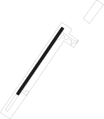
Runway info
| Runway 03 / 21 | ||
| length | 323m (1060ft) | |
| bearing | 54° / 234° | |
| width | 12m (40ft) | |
| surface | asphalt | |
Nearby beacons
| code | identifier | dist | bearing | frequency |
|---|---|---|---|---|
| LYE | LUEBECK NDB | 28.7 | 344° | 394 |
| PAH | SCHWERIN-PARCHIM NDB | 30.1 | 85° | 315 |
| HAM | HAMBURG VORTAC | 31 | 300° | 113.10 |
| BKD | BRUENKENDORF VOR/DME | 31.1 | 112° | 117.70 |
| FSB | FASSBERG NDB | 33.9 | 237° | 284 |
| PMD | DME | 34.5 | 84° | 117.50 |
| ALF | DME | 35.1 | 290° | 115.80 |
| CEL | CELLE NDB | 53 | 227° | 311 |
| HLZ | HEHLINGEN VOR/DME | 57.9 | 182° | 117.30 |
Disclaimer
The information on this website is not for real aviation. Use this data with the X-Plane flight simulator only! Data taken with kind consent from X-Plane 12 source code and data files. Content is subject to change without notice.