Nonnweiler - Schwarzenbach-bostalsee Ul
Airport details
| Country | Germany |
| State | Saarland |
| Region | |
| Airspace | Langen Ctr |
| Municipality | Nonnweiler |
| Elevation | 1643ft (501m) |
| Timezone | GMT +1 |
| Coordinates | 49.59280, 7.03318 |
| Magnetic var | |
| Type | land |
| Available since | X-Plane v10.40 |
| ICAO code | XED003P |
| IATA code | n/a |
| FAA code | n/a |
Communication
| Schwarzenbach-Bostalsee UL Schwarzenbach Info | 121.015 |
Nearby Points of Interest:
St. Wilfridus
-Protestant Church (Hermeskeil)
-Amtsgericht Hermeskeil
-St. Laurentius
-Reitscheider Kreuz
-Mariä Himmelfahrt
-St. Anna
-Paqué brewery, St. Wendel
-Omnibuswartehalle St. Wendel
-St. Katharina
-Kirche Niederbrombach
-Evangelische Kirche (Hoof)
-Church of Reichenbach, near Baumholder
-Bahnhof Hoxel
-Margarethenkirche
-Saint Simon and Jude Thaddaeus, Baumholder
-Evangelical Church Baumholder
-Maria Geburt
-Amtsgericht Ottweiler
-Protestant Church (Sensweiler)
-Jewish cemetery, Illingen
-St. Blasius
-Sommerauer Wasserfall
-Heilig-Kreuz-Kirche
-Herz-Jesu-Kirche
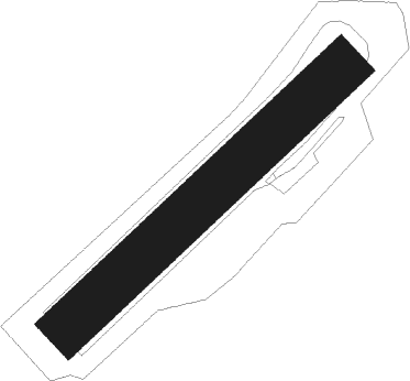
Runway info
| Runway 05 / 23 | ||
| length | 389m (1276ft) | |
| bearing | 62° / 242° | |
| width | 52m (170ft) | |
| surface | grass | |
Nearby beacons
| code | identifier | dist | bearing | frequency |
|---|---|---|---|---|
| FHH | DME | 22.7 | 33° | 117.35 |
| SAD | DME | 23 | 168° | 116.75 |
| RMS | RAMSTEIN TACAN | 23.5 | 106° | 113.40 |
| SR | ENSHEIM (SAARBRUECKEN) NDB | 23.6 | 154° | 360 |
| HAN | HAHN NDB | 24.3 | 34° | 376 |
| SPA | SPANGDAHLEM TACAN | 26.5 | 319° | 109.50 |
| ZWN | ZWEIBRUECKEN VOR/DME | 26.5 | 133° | 114.80 |
| ELU | LUXEMBOURG NDB | 26.8 | 277° | 368 |
| LE | LUXEMBOURG NDB | 30.6 | 273° | 318 |
| LUX | LUXEMBOURG VOR/DME | 30.7 | 273° | 112.25 |
| LW | LUXEMBOURG NDB | 33.4 | 271° | 404 |
| BUE | BUECHEL TACAN | 35.2 | 4° | 117.10 |
| MTZ | METZ NDB | 37.4 | 249° | 354 |
| WLU | LUXEMBOURG NDB | 38.1 | 269° | 346 |
| GTQ | GROSTENQUIN VOR/DME | 38.4 | 208° | 111.25 |
| DIK | DIEKIRCH NDB | 38.6 | 287° | 307 |
| LOU | LORRAINE NDB | 46.5 | 232° | 388 |
| PHG | PHALSBOURG NDB | 50 | 169° | 424 |
| SAV | SAVERNE VOR/DME | 50.5 | 152° | 110.45 |
Disclaimer
The information on this website is not for real aviation. Use this data with the X-Plane flight simulator only! Data taken with kind consent from X-Plane 12 source code and data files. Content is subject to change without notice.