Niederschöna - Mohorn Ul
Airport details
| Country | Germany |
| State | Saxony |
| Region | |
| Airspace | Munich Ctr |
| Municipality | Wilsdruff |
| Elevation | 1199ft (365m) |
| Timezone | GMT +1 |
| Coordinates | 51.00019, 13.45469 |
| Magnetic var | |
| Type | land |
| Available since | X-Plane v10.40 |
| ICAO code | XED003W |
| IATA code | n/a |
| FAA code | n/a |
Communication
| Mohorn UL Mohorn Info | 123.430 |
Nearby Points of Interest:
St. Annen
-Wassermühle Tharandt-Grillenburg
-Wilsdruff transmitter
-Wilsdruff railway station
-Nikolaikirche Wilsdruff
-Burg Tharandt
-Gasthof Niederhermsdorf
-Alte Schule Niederhermsdorf
-Somsdorfer Straße 2
-Freital-Potschappel–Nossen railway line
-Alfred-Damm-Heim
-Rathaus Coßmannsdorf
-Wohnhaus Zöllmener Straße 33
-Schulgebäude Pesterwitzer Straße 23
-Gasthof Kohlsdorf
-Schulgebäude Krönertstraße 25
-Egermühle Deuben
-Rathaus Döhlen
-Stadthaus Dresdner Straße 209
-St. Nikolai
-Lederfabrik Sohre
-Reichardstraße 9
-Dorfkirche Ruppendorf
-Central-Kaufhaus
-Rathaus Niederhäslich (ehem.) Poisentalstraße 75
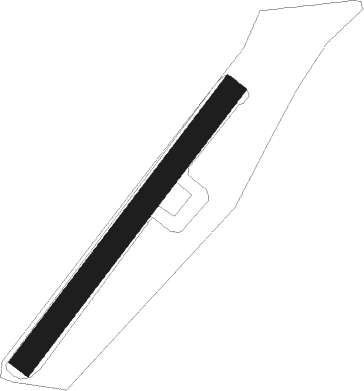
Runway info
| Runway 04 / 22 | ||
| length | 335m (1099ft) | |
| bearing | 55° / 235° | |
| width | 24m (79ft) | |
| surface | grass | |
Nearby beacons
| code | identifier | dist | bearing | frequency |
|---|---|---|---|---|
| DRN | DRESDEN VOR/DME | 5.5 | 84° | 114.35 |
| DND | DME | 13.8 | 67° | 115.40 |
| FS | DRESDEN NDB | 18.8 | 64° | 374 |
| HDO | HERMSDORF VOR/DME | 34.8 | 95° | 108.65 |
| ABU | ALTENBURG NDB | 35.2 | 270° | 330 |
| AGD | DME | 35.6 | 269° | 115.30 |
| LEG | LEIPZIG VOR/DME | 45.2 | 294° | 115.85 |
| HOZ | HOLZDORF TACAN | 47 | 342° | 117.25 |
| HOZ | HOLZDORF NDB | 48.1 | 335° | 406 |
| L | VRATA (KARLOVY VARY) NDB | 52.1 | 213° | 365 |
| V | MASLOVICE (VODOCHODY) NDB | 58.5 | 130° | 416 |
| L | LIBOC (PRAGUE) NDB | 61.6 | 137° | 372 |
| OKL | PRAGUE VOR/DME | 62.5 | 138° | 112.60 |
Disclaimer
The information on this website is not for real aviation. Use this data with the X-Plane flight simulator only! Data taken with kind consent from X-Plane 12 source code and data files. Content is subject to change without notice.