Sankt Johann - Uebersberg
Airport details
| Country | Germany |
| State | Baden-Württemberg |
| Region | |
| Airspace | Langen Ctr |
| Municipality | Lichtenstein |
| Elevation | 2559ft (780m) |
| Timezone | GMT +1 |
| Coordinates | 48.45900, 9.29700 |
| Magnetic var | |
| Type | land |
| Available since | X-Plane v10.40 |
| ICAO code | XED06 |
| IATA code | n/a |
| FAA code | n/a |
Communication
| Uebersberg Uebersberg | 119.435 |
Nearby Points of Interest:
Alte Feuerwache (Reutlingen)
-Haus auf der Alb
-Motorworld Manufaktur Metzingen
-Stift Urach
-Altes Lager Münsingen
-Schwabenhaus
-Stadtmauer Grötzingen
-Thiepval-Kaserne
-Kornhaus
-Gutenhalde
-St. Moriz
-Karmelitenkloster Rottenburg
-Liebfrauenkapelle
-Deffnerstraße 6/1
-Neckarstraße 46
-Neckarstraße 65
-Obertorstraße 42,44,46
-Kanalstraße 12/1
-Haus Obertorstraße 21/23
-Gasthof zum Falken
-Schloss Weil
-Entengrabenstraße 2
-Alte Feuerwache (Esslingen)
-Fleischmannstraße 10
-Innere Brücke 26
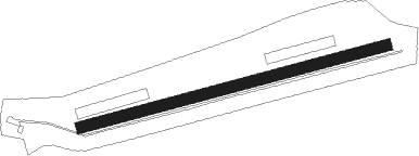
Runway info
| Runway 07 / 25 | ||
| length | 1095m (3593ft) | |
| bearing | 83° / 263° | |
| width | 39m (127ft) | |
| surface | grass | |
Nearby beacons
| code | identifier | dist | bearing | frequency |
|---|---|---|---|---|
| TGO | TANGO TACAN | 9.6 | 347° | 112.50 |
| SGD | DME | 14 | 342° | 115.45 |
| STG | STUTTGART VOR/DME | 14.3 | 350° | 116.85 |
| SUL | SULZ VOR | 26.4 | 263° | 116.10 |
| LBU | LUBURG VOR/DME | 27.3 | 5° | 109.20 |
| LUP | LAUPHEIM NDB | 28.4 | 111° | 407 |
| KRH | KARLSRUHE VOR/DME | 42.7 | 307° | 115.95 |
| SHD | HALL DME | 43.8 | 36° | 108.05 |
| ALD | (MEMMINGEN/ALLGAU) DME | 46.8 | 117° | 117.20 |
| ALG | ALLGAEU (MEMMINGEN) NDB | 47.5 | 116° | 341 |
| FHD | DME | 48.2 | 165° | 112.60 |
| DKB | DINKELSBUEHL VORTAC | 55.4 | 54° | 117.80 |
| ZUE | ZURICH EAST VOR/DME | 55.5 | 209° | 110.05 |
| NKR | NECKAR NDB | 57.2 | 327° | 292 |
| TRA | DME | 57.6 | 228° | 114.30 |
| NDD | DME-ILS | 61.9 | 35° | 108.70 |
| NSN | NIEDERSTETTEN NDB | 62 | 36° | 311 |
Disclaimer
The information on this website is not for real aviation. Use this data with the X-Plane flight simulator only! Data taken with kind consent from X-Plane 12 source code and data files. Content is subject to change without notice.