Steinheim Am Albuch - Steinheimer Schaefhalde
Airport details
| Country | Germany |
| State | Baden-Württemberg |
| Region | |
| Airspace | Munich Ctr |
| Municipality | Steinheim am Albuch |
| Elevation | 2064ft (629m) |
| Timezone | GMT +1 |
| Coordinates | 48.69004, 10.09658 |
| Magnetic var | |
| Type | land |
| Available since | X-Plane v10.40 |
| ICAO code | XED08 |
| IATA code | n/a |
| FAA code | n/a |
Communication
| Steinheimer Schaefhalde Schaefhalde Start | 118.940 |
Nearby Points of Interest:
Kloster Herbrechtingen
-Steiff-Fabrik
-Jupitergigantensäule von Walheim
-Altes Schulhaus Bargau
-Postamt Neresheim
-Alter Bau
-Siechenkapelle
-St. Nemesius
-Pfarrhaus (Bächingen an der Brenz)
-Dorfschmiede (Haunsheim)
-St. Vitus (Reistingen)
-Jüdischer Friedhof Aufhausen
-Haltepunkt Schwäbisch Gmünd Süd
-Rectory (Wittislingen)
-Marienplatz 5
-Rechbergsche Scheuer
-Rathaus Schwäbisch Gmünd
-Schloss Eglingen
-Hauptstraße 43
-Kapitelshaus Schwäbisch Gmünd
-Grät Schwäbisch Gmünd
-Rathaus
-Stadtarchiv Schwäbisch Gmünd
-Spital zum hl. Geist Schwäbisch Gmünd
-Alte PH
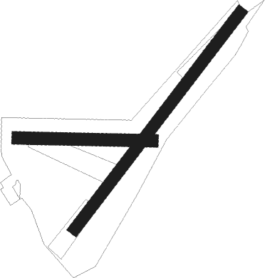
Runway info
Runway 05 / 23  | ||
| length | 804m (2638ft) | |
| bearing | 54° / 234° | |
| width | 35m (114ft) | |
| surface | grass | |
| Runway 09 / 27 | ||
| length | 396m (1299ft) | |
| bearing | 94° / 274° | |
| width | 37m (121ft) | |
| surface | grass | |
Nearby beacons
| code | identifier | dist | bearing | frequency |
|---|---|---|---|---|
| DKB | DINKELSBUEHL VORTAC | 27.7 | 17° | 117.80 |
| SHD | HALL DME | 28.5 | 323° | 108.05 |
| LUP | LAUPHEIM NDB | 29.2 | 201° | 407 |
| LBU | LUBURG VOR/DME | 32.7 | 286° | 109.20 |
| STG | STUTTGART VOR/DME | 33.3 | 270° | 116.85 |
| TGO | TANGO TACAN | 33.4 | 265° | 112.50 |
| SGD | DME | 34.5 | 270° | 115.45 |
| AGB | AUGSBURG NDB | 36.8 | 108° | 318 |
| AUG | DME | 37 | 107° | 115.90 |
| ALG | ALLGAEU (MEMMINGEN) NDB | 42.1 | 167° | 341 |
| ALD | (MEMMINGEN/ALLGAU) DME | 42.4 | 169° | 117.20 |
| NDD | DME-ILS | 42.5 | 349° | 108.70 |
| LCH | LECHFELD TACAN | 42.6 | 123° | 108.80 |
| NSN | NIEDERSTETTEN NDB | 42.6 | 349° | 311 |
| ANS | ANSBACH NDB | 42.7 | 41° | 452 |
| ILM | ILLESHEIM NDB | 48.3 | 20° | 488 |
| KPT | KEMPTEN VOR/DME | 57.6 | 165° | 108.40 |
| NUB | NUERNBERG VOR/DME | 61.1 | 49° | 115.75 |
| NGD | DME | 62.2 | 50° | 113.10 |
Disclaimer
The information on this website is not for real aviation. Use this data with the X-Plane flight simulator only! Data taken with kind consent from X-Plane 12 source code and data files. Content is subject to change without notice.