Mössingen - Farrenberg
Airport details
| Country | Germany |
| State | Baden-Württemberg |
| Region | |
| Airspace | Langen Ctr |
| Municipality | Mössingen |
| Elevation | 2641ft (805m) |
| Timezone | GMT +1 |
| Coordinates | 48.38690, 9.07150 |
| Magnetic var | |
| Type | land |
| Available since | X-Plane v10.40 |
| ICAO code | XED6A |
| IATA code | n/a |
| FAA code | n/a |
Communication
Nearby Points of Interest:
St. Ulrich (Thanheim)
-St. Moriz
-Karmelitenkloster Rottenburg
-Thiepval-Kaserne
-Schwabenhaus
-Kornhaus
-Alte Feuerwache (Reutlingen)
-Denkmal für die Gefallenen des Ersten Weltkriegs
-Gasthaus Rössle (Trillfingen)
-Category:St Anna Church (Haigerloch)
-Friedhofkirche Balingen
-Marktbrunnen (Balingen)
-Stadtkirche Balingen
-Stadtbefestigung Balingen
-Viehmarktplatz 8
-Spital (Balingen)
-Motorworld Manufaktur Metzingen
-Haus auf der Alb
-Stift Urach
-Spitalkirche Herrenberg
-Burg Rohrau
-Stadtmauer Grötzingen
-Gutenhalde
-Schloss Gärtringen
-Aufbaugymnasium Nagold
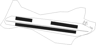
Runway info
Runway 10L / 28R  | ||
| length | 171m (561ft) | |
| bearing | 98° / 278° | |
| width | 40m (131ft) | |
| surface | grass | |
| Runway 10R / 28L | ||
| length | 304m (997ft) | |
| bearing | 99° / 279° | |
| width | 40m (131ft) | |
| surface | grass | |
| Runway 10 / 28 | ||
| length | 747m (2451ft) | |
| bearing | 98° / 278° | |
| width | 35m (115ft) | |
| surface | grass | |
Nearby beacons
| code | identifier | dist | bearing | frequency |
|---|---|---|---|---|
| TGO | TANGO TACAN | 15.7 | 39° | 112.50 |
| SUL | SULZ VOR | 17 | 269° | 116.10 |
| SGD | DME | 19 | 27° | 115.45 |
| STG | STUTTGART VOR/DME | 19.9 | 31° | 116.85 |
| LBU | LUBURG VOR/DME | 33.3 | 27° | 109.20 |
| LUP | LAUPHEIM NDB | 35 | 101° | 407 |
| KRH | KARLSRUHE VOR/DME | 41.2 | 321° | 115.95 |
| KBD | DME | 45.6 | 292° | 115.80 |
| KBA | KARLSRUHE/BADEN-BADEN NDB | 45.8 | 293° | 431 |
| FHD | DME | 46.5 | 149° | 112.60 |
| ZUE | ZURICH EAST VOR/DME | 48.8 | 198° | 110.05 |
| TRA | DME | 49 | 222° | 114.30 |
| SHD | HALL DME | 51.9 | 44° | 108.05 |
| NKR | NECKAR NDB | 58.5 | 340° | 292 |
| KLO | KLOTEN (ZURICH) VOR/DME | 59.7 | 209° | 114.85 |
Disclaimer
The information on this website is not for real aviation. Use this data with the X-Plane flight simulator only! Data taken with kind consent from X-Plane 12 source code and data files. Content is subject to change without notice.