Goslar - Bollrich
Airport details
| Country | Germany |
| State | Lower Saxony |
| Region | |
| Airspace | Bremen Ctr |
| Municipality | Goslar |
| Elevation | 892ft (272m) |
| Timezone | GMT +1 |
| Coordinates | 51.90598, 10.46183 |
| Magnetic var | |
| Type | land |
| Available since | X-Plane v11.55 |
| ICAO code | XEDA4 |
| IATA code | n/a |
| FAA code | n/a |
Communication
Nearby Points of Interest:
Oberes Wasserloch
-Evangelische Kirche Vienenburg
-Upper Harz Water Regale
-Kirche Klein Mahner
-Princess Ilse
-Klosterkirche Stötterlingenburg
-Ilsenburg Factory
-Wolkenhäuschen
-St. Georgskirche
-Wetterstation Brocken
-Christuskirche in Gitter am Berge
-Plessenburg
-Am Markt 14
-Sankt-Laurentius-Kirche
-Sankt-Katharina-Kirche
-Ütschenteich
-Rathaus Schierke
-Alte Kirche Schierke
-Boetersmühle
-Friedrichstraße 77
-St. Johannes
-Konkordienkirche Hasserode
-Grünhirscher Stollen
-Mönchstieg 21
-Wormsgraben
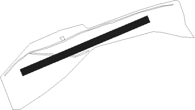
Runway info
| Runway 07 / 25 | ||
| length | 637m (2090ft) | |
| bearing | 78° / 258° | |
| width | 34m (112ft) | |
| surface | grass | |
| blast zone | 117m (384ft) / 178m (584ft) | |
Nearby beacons
| code | identifier | dist | bearing | frequency |
|---|---|---|---|---|
| BRU | BRAUNSCHWEIG-WOLFSBURG NDB | 25.5 | 19° | 427 |
| DLE | LEINE VOR/DME | 29.7 | 301° | 115.20 |
| SAS | SARSTEDT VOR/DME | 29.7 | 301° | 114.45 |
| HLZ | HEHLINGEN VOR/DME | 30 | 36° | 117.30 |
| CB | COCHSTEDT NDB | 36.7 | 93° | 344 |
| HA | HANNOVER NDB | 41.3 | 310° | 320 |
| CEL | CELLE NDB | 44 | 328° | 311 |
| HAD | DME | 44 | 306° | 113.95 |
| HBD | DME | 44.2 | 304° | 116.90 |
| HW | HANNOVER NDB | 47.7 | 302° | 358 |
| EFD | DME | 58.4 | 152° | 112.05 |
| ERF | ERFURT VOR/DME | 64.2 | 141° | 113.85 |
Disclaimer
The information on this website is not for real aviation. Use this data with the X-Plane flight simulator only! Data taken with kind consent from X-Plane 12 source code and data files. Content is subject to change without notice.