Emsdetten - Borghorst Fuechten
Airport details
| Country | Germany |
| State | North Rhine-Westphalia |
| Region | |
| Airspace | Langen Ctr |
| Municipality | Steinfurt |
| Elevation | 126ft (38m) |
| Timezone | GMT +1 |
| Coordinates | 52.14989, 7.44976 |
| Magnetic var | |
| Type | land |
| Available since | X-Plane v11.55 |
| ICAO code | XEDA5 |
| IATA code | n/a |
| FAA code | n/a |
Communication
| Borghorst Fuechten Borghorst Start | 123.260 |
Nearby Points of Interest:
Aloysiuskapelle (Borghorst)
-Konzerthalle im Steinfurter Bagno
-St. Arnold railway station
-Haus Markt 16
-Old Saint John the Baptist Church
-St. Anna
-Jüdischer Friedhof (Metelen)
-Saline Gottesgabe
-Schleuse Bergeshövede
-Evangelisch-reformierte Kirche Ohne
-Kriegsgräberstätte Haus Spital
-Speicherstadt Münster
-St. Antonius Abt
-Amtsgericht Ibbenbüren
-Herold House
-Weidenhof
-Torhäuser am Neutor
-Jüdischer Friedhof (Ibbenbüren)
-St. Maria Heil der Kranken
-Deutsches Studentenheim
-Amtsgericht Münster
-Burg Nienborg
-Astronomische Uhr, Paulusdom, Münster
-Lotharinger Chorfrauenkirche
-Geologisch-Paläontologisches Museum Münster
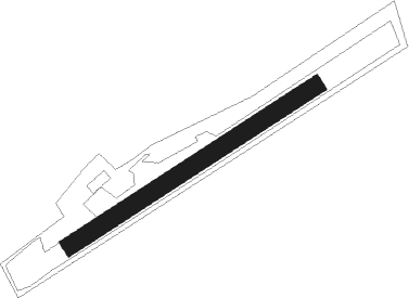
Runway info
| Runway 06 / 24 | ||
| length | 603m (1978ft) | |
| bearing | 71° / 251° | |
| width | 37m (121ft) | |
| surface | grass | |
Nearby beacons
| code | identifier | dist | bearing | frequency |
|---|---|---|---|---|
| MOD | DME | 8.7 | 93° | 114.05 |
| MYN | MUENSTER/OSNABRUECK NDB | 12.9 | 88° | 371 |
| HMM | HAMM VOR/DME | 20 | 139° | 115.65 |
| RKN | DME | 25.2 | 269° | 116.80 |
| OSB | OSNABRUCK TACAN | 30.9 | 87° | 108.35 |
| OSN | OSNABRUECK VOR | 30.9 | 87° | 114.30 |
| BOT | BOTTROP NDB | 37.3 | 217° | 406 |
| DWI | DORTMUND-WICKEDE NDB | 38 | 164° | 357 |
| DOR | WICKEDE (DORTMUND) VOR/DME | 38.1 | 164° | 108.65 |
| BAM | BARMEN VOR/DME | 50.4 | 198° | 114 |
| LI | DUESSELDORF NDB | 52.5 | 215° | 417 |
| DUS | DUESSELDORF VOR/DME | 58.1 | 219° | 115.15 |
| GMH | GERMINGHAUSEN VOR/DME | 61 | 156° | 115.40 |
| DY | DUESSELDORF NDB | 62.4 | 221° | 284 |
| MHV | MOENCHENGLADBACH VOR | 65.4 | 226° | 109.80 |
| MHD | DME | 65.5 | 226° | 112.50 |
Disclaimer
The information on this website is not for real aviation. Use this data with the X-Plane flight simulator only! Data taken with kind consent from X-Plane 12 source code and data files. Content is subject to change without notice.