Ostheim - Buechig
Airport details
| Country | Germany |
| State | Bavaria |
| Region | |
| Airspace | Langen Ctr |
| Municipality | Ostheim v.d.Rhön |
| Elevation | 1258ft (383m) |
| Timezone | GMT +1 |
| Coordinates | 50.44819, 10.25361 |
| Magnetic var | |
| Type | land |
| Available since | X-Plane v10.40 |
| ICAO code | XEDA8 |
| IATA code | n/a |
| FAA code | n/a |
Communication
| Buechig Ostheim Info | 123.375 |
Nearby Points of Interest:
Schloss
-Frickenhäuser See
-Kirche
-Pfarrkirche
-Jewish cemetery, Oberwaldbehrungen
-Basilika
-Kirche Hermannsfeld
-Kuratiekirche
-Filialkirche
-Rathaus
-Feuerwehrgerätehaus
-St. Michael
-Mariä Geburt
-Gemeindebrauhaus
-St. Laurentius (Schönau an der Brend)
-Pfarrhaus
-Kapelle
-Monastery Neustadt an der Saale
-Burgruine
-Protestant Church (Geba)
-Burg Untermaßfeld
-Altar
-Schule am Pulverrasen
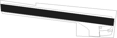
Runway info
Runway 10C / 28C  | ||
| length | 191m (627ft) | |
| bearing | 98° / 278° | |
| width | 12m (38ft) | |
| surface | asphalt | |
| Runway 10 / 28 | ||
| length | 586m (1923ft) | |
| bearing | 98° / 278° | |
| width | 38m (126ft) | |
| surface | grass | |
Nearby beacons
| code | identifier | dist | bearing | frequency |
|---|---|---|---|---|
| FUL | FULDA VOR/DME | 27.4 | 282° | 112.10 |
| EFD | DME | 41.7 | 53° | 112.05 |
| ERF | ERFURT VOR/DME | 48 | 63° | 113.85 |
| FTZ | FRITZLAR NDB | 49.7 | 307° | 468 |
| ERL | ERLANGEN VOR/DME | 58.8 | 131° | 114.90 |
| ILM | ILLESHEIM NDB | 58.8 | 172° | 488 |
| NUB | NUERNBERG VOR/DME | 64.2 | 140° | 115.75 |
| NGD | DME | 65.2 | 139° | 113.10 |
| DKS | DME-ILS | 66.6 | 319° | 111.50 |
| RTB | ROETHENBACH NDB | 69.6 | 134° | 415 |
Disclaimer
The information on this website is not for real aviation. Use this data with the X-Plane flight simulator only! Data taken with kind consent from X-Plane 12 source code and data files. Content is subject to change without notice.