Stöckelsberg - Altdorf-hagenhausen
Airport details
| Country | Germany |
| State | Bavaria |
| Region | |
| Airspace | Munich Ctr |
| Municipality | Altdorf bei Nürnberg |
| Elevation | 1753ft (534m) |
| Timezone | GMT +1 |
| Coordinates | 49.38550, 11.41837 |
| Magnetic var | |
| Type | land |
| Available since | X-Plane v10.32 |
| ICAO code | XEDAC |
| IATA code | n/a |
| FAA code | n/a |
Communication
| Altdorf-Hagenhausen Altdorf Info | 129.975 |
Nearby Points of Interest:
Burgstall Hohenrasch
-Eratsmühle
-Steinerne Rinne bei Raschbach
-Rathaus in Altdorf bei Nürnberg
-Ehemaliges Pflegschloss in Altdorf bei Nürnberg
-Burgstall Hohenkuchen
-Deinschwang 11
-Teufelskirche von Grünsberg
-Glocken- und Uhrturm in Burgthann
-Rumpelbachschlucht
-Turmhügel Egensbach
-Burgruine in Burgthann
-Evang.-Luth. Pfarrkirche St. Veit in Schwarzenbruck
-Steinkreuz in Engelthal
-Kloster Engelthal
-Ehemaliges Wohnstallhaus in Engelthal
-Burgstall Troßberg
-Bauernhof und Wohnstallhaus in Feucht
-Burgruine in Happurg
-Evang.-Luth. Anstaltskirche in Schwarzenbruck
-Gefütterter Graben bei Ungelstetten
-Papierfabrik Neumarkt Oberpfalz
-Burgstall Leherfels
-Kapuzinerkloster Neumarkt in der Oberpfalz
-Altes Gemeindehaus in Leinburg
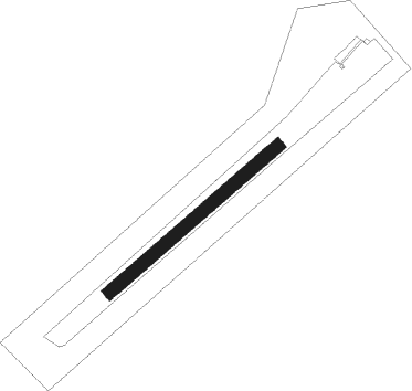
Runway info
| Runway 05 / 23 | ||
| length | 501m (1644ft) | |
| bearing | 64° / 244° | |
| width | 30m (98ft) | |
| surface | grass | |
Nearby beacons
| code | identifier | dist | bearing | frequency |
|---|---|---|---|---|
| RTB | ROETHENBACH NDB | 8.7 | 300° | 415 |
| NGD | DME | 14.9 | 289° | 113.10 |
| NUB | NUERNBERG VOR/DME | 16.5 | 287° | 115.75 |
| ERL | ERLANGEN VOR/DME | 19.2 | 315° | 114.90 |
| HFX | HOHENFELS NDB | 19.9 | 111° | 286 |
| GRF | GRAFENWOHR TACAN | 27.3 | 60° | 111.80 |
| GRW | GRAFENWOHR NDB | 27.5 | 59° | 405 |
| ANS | ANSBACH NDB | 31.1 | 264° | 452 |
| BAY | BAYREUTH VOR | 36.9 | 20° | 110.60 |
| IGL | INGOLSTADT NDB | 39.9 | 161° | 345 |
| IGL | INGOLSTADT TACAN | 40.5 | 167° | 111.40 |
| NEU | NEUBURG TACAN | 41.2 | 197° | 108.90 |
| MIQ | MIKE NDB | 49.4 | 168° | 426 |
| WLD | WALDA VOR/DME | 49.7 | 200° | 112.80 |
| OKG | CHEB VOR/DME | 55.9 | 55° | 115.70 |
| AUG | DME | 60.7 | 207° | 115.90 |
| AGB | AUGSBURG NDB | 60.8 | 207° | 318 |
Disclaimer
The information on this website is not for real aviation. Use this data with the X-Plane flight simulator only! Data taken with kind consent from X-Plane 12 source code and data files. Content is subject to change without notice.