Airports for X-Plane offers a convenient way to explore airports and their related communication information for the X-Plane flight simulator. It only uses data from the X-Plane flight simulator itself, and is therefore more reliable than the data that comes from real aviation websites. You can search for airports by using the ICAO code, or browse for airports per country and state. The information displayed is categorized by airport details, runway information, airport communication, approach frequencies (ILS and Glidepath details), details of nearby beacons, SIDs, STARs and approach procedures.

airliner buildings arriving newark landing area takeoff airdrome airspeed hospital runway lighting consulate stopover train station train field taxiway heliport plane control tower helipad

Rhede - Alte Ems

Airport details

CountryGermany
StateLower Saxony
Region
AirspaceBremen Ctr
MunicipalityHeede
Elevation5ft (2m)
TimezoneGMT +1
Coordinates53.03135, 7.30019
Magnetic var
Typeland
Available sinceX-Plane v10.32
ICAO codeXEDAD
IATA coden/a
FAA coden/a

Communication

Alte Ems Alte Ems Info120.890
Nearby Points of Interest:
St. Petrus in Ketten
-
Vellager Kirche
-
Stapelmoorer Kirche
-
Mitling-Marker Kirche
-
Church of Vriescheloo
-
Holthuser Kirche
-
Rechthuis
-
St. Nikolaus
-
Kerk van Sellingen
-
Organeum
-
St. Joseph
-
Kerk van Wedde
-
St. Johannes Baptist (Grotegaste)
-
Dorpsstraat 1
-
Synagoge Bad Nieuweschans
-
Hoofdwacht
-
Garnizoenskerk (Bad Nieuweschans)
-
Reformierte Kirche
-
Historischer Garten Tammen in Bunderhee
-
Hoofdweg 81, Nieuw-Beerta
-
Villaboerderij met voorhuis in regionale Amsterdamse Schoolstijl en aangebouwde bijschuur
-
Dwarshuisboerderij van het Oldambtster type
-
War memorial in Nieuw-Beerta
-
Verlengde Hoofdweg 3
-
Verlengde Hoofdweg 2

Runway info

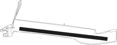
Runway 10 / 28
 length727m (2385ft)
 bearing97° / 277°
 width30m (98ft)
 surfacegrass

Airport layout


Nearby beacons

codeidentifierdistbearingfrequency
EELEELDE (GRONINGEN) VOR/DME24.1282°112.40
WTMWITTMUNDHAFEN TACAN34.939°113.50
MODDME55.4157°114.05
MYNMUENSTER/OSNABRUECK NDB55.4150°371
RKNDME57.3211°116.80
OSBOSNABRUCK TACAN61.5130°108.35
OSNOSNABRUECK VOR61.5130°114.30

Disclaimer

The information on this website is not for real aviation. Use this data with the X-Plane flight simulator only! Data taken with kind consent from X-Plane 12 source code and data files. Content is subject to change without notice.