Hof - Bad Marienberg / Oberrossbach
Airport details
| Country | Germany |
| State | Rhineland-Palatinate |
| Region | |
| Airspace | Langen Ctr |
| Municipality | Oberroßbach |
| Elevation | 1729ft (527m) |
| Timezone | GMT +1 |
| Coordinates | 50.66209, 8.02204 |
| Magnetic var | |
| Type | land |
| Available since | X-Plane v10.32 |
| ICAO code | XEDAP |
| IATA code | n/a |
| FAA code | n/a |
Communication
| Bad Marienberg / Oberrossbach Hof | 120.085 |
Nearby Points of Interest:
Evangelische Kirche
-Protestant Church
-Oberburg Driedorf
-Evangelische Kirche Driedorf
-Ehemalige Evangelische Kirche
-Hofhaus Langendernbach
-St. Aloisius (Herdorf)
-Evangelische Kapelle
-Denkmal 1914/18
-Evangelische Kirche Haiger-Allendorf
-Motte Streithausen
-Pfarrkirche Nenderoth
-Dornburg (Oppidum)
-St. Johannes (Guckheim)
-Abteikirche Marienstatt
-Evangelische Kirche Herborn-Guntersdorf
-Katholische Kirche
-Westerwaldstraße 39
-Westerwaldstraße 25
-Westerwaldstraße 16
-Burg Ellar
-St. Martinus
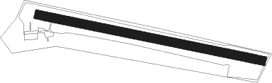
Runway info
| Runway 10 / 28 | ||
| length | 859m (2818ft) | |
| bearing | 100° / 280° | |
| width | 34m (111ft) | |
| surface | grass | |
Nearby beacons
| code | identifier | dist | bearing | frequency |
|---|---|---|---|---|
| SLD | DME | 3.4 | 52° | 108.05 |
| SIL | SIEGERLAND NDB | 4.5 | 81° | 489 |
| COL | COLA VOR/DME | 17.8 | 286° | 108.80 |
| TAU | TAUNUS VOR/DME | 25.2 | 161° | 113.35 |
| GMH | GERMINGHAUSEN VOR/DME | 30.9 | 346° | 115.40 |
| LV | COLOGNE-BONN NDB | 30.9 | 280° | 327 |
| LW | COLOGNE-BONN NDB | 32.4 | 287° | 300 |
| KBO | COLOGNE-BONN VOR/DME | 35.3 | 283° | 112.15 |
| WYP | WIPPER VOR | 36.4 | 297° | 109.60 |
| WIB | WIESBADEN TACAN | 38.6 | 155° | 114.10 |
| MTR | METRO VOR | 39.1 | 115° | 110 |
| LJ | COLOGNE-BONN NDB | 39.7 | 285° | 365 |
| FW | FRANKFURT NDB | 42.4 | 148° | 382 |
| FRD | DME | 43.3 | 139° | 115.90 |
| FFM | FRANKFURT VORTAC | 43.4 | 135° | 114.20 |
| FR | FRANKFURT NDB | 43.8 | 132° | 297 |
| VFM | NAUHEIM VOR | 45.4 | 147° | 113.75 |
| BUE | BUECHEL TACAN | 46.5 | 243° | 117.10 |
| HAN | HAHN NDB | 50.6 | 227° | 376 |
| BAM | BARMEN VOR/DME | 51.1 | 308° | 114 |
| FHH | DME | 52.2 | 227° | 117.35 |
| DOR | WICKEDE (DORTMUND) VOR/DME | 53.9 | 336° | 108.65 |
| DWI | DORTMUND-WICKEDE NDB | 53.9 | 336° | 357 |
| RID | RIED VOR/DME | 56.5 | 149° | 112.20 |
| PAD | DME-ILS | 61.2 | 32° | 108.50 |
| PAD | PADERBORN-LIPPSTADT NDB | 62.2 | 33° | 354 |
| BOT | BOTTROP NDB | 67 | 313° | 406 |
Disclaimer
The information on this website is not for real aviation. Use this data with the X-Plane flight simulator only! Data taken with kind consent from X-Plane 12 source code and data files. Content is subject to change without notice.