Gedern
Airport details
| Country | Germany |
| State | Hesse |
| Region | |
| Airspace | Langen Ctr |
| Municipality | Gedern |
| Elevation | 1212ft (369m) |
| Timezone | GMT +1 |
| Coordinates | 50.43327, 9.19673 |
| Magnetic var | |
| Type | land |
| Available since | X-Plane v10.40 |
| ICAO code | XEDB5 |
| IATA code | n/a |
| FAA code | n/a |
Communication
| Gedern Gedern Info | 120.000 |
Nearby Points of Interest:
Kirche Maria Königin des Friedens (vorm. Synagoge, Wenings)
-Evangelische Kirche Busenborn
-Evangelische Kirche (Unter-Lais)
-Synagoge Lichenroth
-Evangelische Kirche Bindsachsen
-St. Laurentius (Usenborn)
-Evangelische Pfarrkirche (Eichelsdorf, Nidda)
-Evangelische Pfarrkirche (Schwickartshausen)
-Bismarck Tower
-Edelhof
-Evangelische Kirche Stornfels
-Rathaus Ortenberg
-Evangelische Kirche (Ilbeshausen)
-Evangelische Kirche
-Naxburg
-Evangelische Kirche Freiensteinau
-Bad Salzhausen station
-Evangelische Kirche Gonterskirchen
-Evangelische Kapelle
-Evangelische Kirche Altenhain
-Schlossberg Ulrichstein
-Evangelische Kirche Geiß-Nidda
-Altstadt (Büdingen)
-Westermann’sches Haus
-Altstadt 7, 9 (Büdingen)
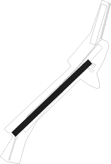
Runway info
| Runway 04 / 22 | ||
| length | 599m (1965ft) | |
| bearing | 63° / 243° | |
| width | 34m (111ft) | |
| surface | grass | |
Nearby beacons
| code | identifier | dist | bearing | frequency |
|---|---|---|---|---|
| GED | GEDERN VORTAC | 2.3 | 112° | 110.80 |
| MTR | METRO VOR | 16.3 | 246° | 110 |
| FUL | FULDA VOR/DME | 17.2 | 67° | 112.10 |
| FR | FRANKFURT NDB | 29.5 | 234° | 297 |
| CHA | CHARLIE VOR/DME | 31.3 | 197° | 115.35 |
| FFM | FRANKFURT VORTAC | 31.3 | 236° | 114.20 |
| FRD | DME | 34.2 | 237° | 115.90 |
| FW | FRANKFURT NDB | 39.1 | 241° | 382 |
| VFM | NAUHEIM VOR | 39.7 | 237° | 113.75 |
| FTZ | FRITZLAR NDB | 39.9 | 19° | 468 |
| WIB | WIESBADEN TACAN | 41.2 | 246° | 114.10 |
| RID | RIED VOR/DME | 46.5 | 225° | 112.20 |
| DKS | DME-ILS | 59.8 | 12° | 111.50 |
| MND | DME | 63.5 | 215° | 113.55 |
Disclaimer
The information on this website is not for real aviation. Use this data with the X-Plane flight simulator only! Data taken with kind consent from X-Plane 12 source code and data files. Content is subject to change without notice.