Celle - Celle-scheuen
Airport details
| Country | Germany |
| State | Lower Saxony |
| Region | |
| Airspace | Bremen Ctr |
| Municipality | Celle |
| Elevation | 186ft (57m) |
| Timezone | GMT +1 |
| Coordinates | 52.67100, 10.08800 |
| Magnetic var | |
| Type | land |
| Available since | X-Plane v10.40 |
| ICAO code | XEDBC |
| IATA code | n/a |
| FAA code | n/a |
Communication
| Celle-Scheuen Scheuen Info | 134.535 |
Nearby Points of Interest:
Seeckt-Kaserne
-Im Güldenen Winkel 8
-Italienischer Garten
-Wohnhausgruppe Waack
-St. Marien-Kirche (Wienhausen)
-Gut Rixförde
-Amtshof Eicklingen
-St. Marienkirche
-St. Marcus, Engensen
-St. Georgs-Kirche
-Ostenholz church
-Kirchfriedhof Kirchhorst
-Steller Straße 15
-Faßberg Air Base
-Christophoruskirche in Sprakensehl
-Nikolaikirche
-Elisabeth Church from 1867 in Langenhagen
-St. Pauli
-Helstorfer Kirche
-Groß-Buchholzer-Kirchweg 66 (Hannover)
-Hof Burzlaff
-Kurhaus Friedenstal (Hannover)
-St.-Sebastian-Kirche
-Evangelische Dorfkirche Vöhrum
-St. Georg-Kirche
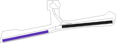
Runway info
Runway 09 / 27  | ||
| length | 497m (1631ft) | |
| bearing | 89° / 269° | |
| width | 27m (88ft) | |
| surface | grass | |
| Runway 08 / 26 | ||
| length | 461m (1512ft) | |
| bearing | 86° / 266° | |
| width | 24m (78ft) | |
| surface | grass | |
Nearby beacons
| code | identifier | dist | bearing | frequency |
|---|---|---|---|---|
| CEL | CELLE NDB | 5.3 | 216° | 311 |
| FSB | FASSBERG NDB | 15.1 | 22° | 284 |
| HA | HANNOVER NDB | 16.1 | 234° | 320 |
| HAD | DME | 18.7 | 243° | 113.95 |
| HBD | DME | 20.3 | 243° | 116.90 |
| HW | HANNOVER NDB | 23.2 | 249° | 358 |
| NIE | NIENBURG VOR | 26.2 | 266° | 116.50 |
| DLE | LEINE VOR/DME | 26.3 | 206° | 115.20 |
| SAS | SARSTEDT VOR/DME | 26.3 | 206° | 114.45 |
| WUN | WUNSTORF TACAN | 27.3 | 252° | 114.85 |
| BRU | BRAUNSCHWEIG-WOLFSBURG NDB | 28.2 | 124° | 427 |
| HLZ | HEHLINGEN VOR/DME | 31.7 | 114° | 117.30 |
| BYC | BUECKEBURG NDB | 43 | 249° | 368 |
| ALF | DME | 58 | 354° | 115.80 |
Disclaimer
The information on this website is not for real aviation. Use this data with the X-Plane flight simulator only! Data taken with kind consent from X-Plane 12 source code and data files. Content is subject to change without notice.