Deckenpfronn - Deckenpfronn-egelsee
Airport details
| Country | Germany |
| State | Baden-Württemberg |
| Region | ED |
| Airspace | Langen Ctr |
| Municipality | Deckenpfronn |
| Elevation | 1895ft (578m) |
| Timezone | GMT +1 |
| Coordinates | 48.63861, 8.81794 |
| Magnetic var | |
| Type | land |
| Available since | X-Plane v10.40 |
| ICAO code | XEDBF |
| IATA code | n/a |
| FAA code | n/a |
Communication
Nearby Points of Interest:
Schloss Gärtringen
-Spitalkirche Herrenberg
-Burg Rohrau
-Aufbaugymnasium Nagold
-Wasserkraftwerk Nagold
-Hölzersee
-Karmelitenkloster Rottenburg
-St. Moriz
-Eiermann campus
-Kornhaus
-Schwabenhaus
-Thiepval-Kaserne
-Gartenhalle
-Universitätssternwarte Pfaffenwald
-Pfarrhaus
-Altes Rathaus
-Gasthaus Rössle (Trillfingen)
-Kollmar & Jourdan House
-Schwabtunnel
-Glemsmühle
-Villa Kienlin, Stuttgart
-Ehemaliges Bezirksamt, Bahnhofstraße 22–26, Pforzheim
-Industriehaus Pforzheim
-Furtbachhaus
-Gutenhalde
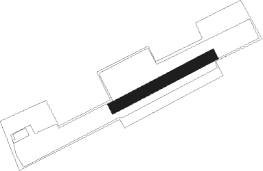
Runway info
| Runway 06 / 24 | ||
| length | 373m (1224ft) | |
| bearing | 74° / 254° | |
| width | 38m (126ft) | |
| surface | grass | |
Nearby beacons
| code | identifier | dist | bearing | frequency |
|---|---|---|---|---|
| SGD | DME | 16.3 | 83° | 115.45 |
| SUL | SULZ VOR | 16.9 | 214° | 116.10 |
| TGO | TANGO TACAN | 17.5 | 93° | 112.50 |
| STG | STUTTGART VOR/DME | 17.7 | 82° | 116.85 |
| KRH | KARLSRUHE VOR/DME | 23.2 | 327° | 115.95 |
| LBU | LUBURG VOR/DME | 26.4 | 62° | 109.20 |
| KBA | KARLSRUHE/BADEN-BADEN NDB | 30.1 | 282° | 431 |
| KBD | DME | 30.1 | 281° | 115.80 |
| NKR | NECKAR NDB | 42 | 353° | 292 |
| LRD | DME | 42.7 | 255° | 108.05 |
| SHD | HALL DME | 47.5 | 64° | 108.05 |
| MND | DME | 51.3 | 340° | 113.55 |
| TRA | DME | 59 | 202° | 114.30 |
| FHD | DME | 64.4 | 145° | 112.60 |
Disclaimer
The information on this website is not for real aviation. Use this data with the X-Plane flight simulator only! Data taken with kind consent from X-Plane 12 source code and data files. Content is subject to change without notice.