Oedheim - Degmarn
Airport details
| Country | Germany |
| State | Baden-Württemberg |
| Region | |
| Airspace | Langen Ctr |
| Municipality | Oedheim |
| Elevation | 507ft (155m) |
| Timezone | GMT +1 |
| Coordinates | 49.25719, 9.27272 |
| Magnetic var | |
| Type | land |
| Available since | X-Plane v10.40 |
| ICAO code | XEDBG |
| IATA code | n/a |
| FAA code | n/a |
Communication
| Degmarn Degmarn Info | 118.410 |
Nearby Points of Interest:
Holy Trinity Chapel
-Saint Luke Church
-Grabkapelle der Freiherren von Ellrichshausen
-Taharahaus
-Lindenplatz 5
-Böllinger Mühle
-Böckinger Straße 7
-Hartlesbrunnen
-Mittelstraße 13 und 15
-Pfarrhaus (Neckargartach)
-Wartberg-Gasthaus (Heilbronn)
-Ludwig’sche Mühle
-Altes Wasserwerk
-Böckinger Straße 98
-Wartbergsteige (Heilbronn)
-Villa Binder (Heilbronn-Neckargartach)
-Baukelter Weinsberg
-Rappengasse 6
-Villa Racher
-Pfühlstraße 51
-Karlstraße 82
-Karlstraße 72
-Kernerstraße 60
-Handkran auf der Kraneninsel (Heilbronn)
-Stauchenstraße 22
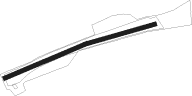
Runway info
Runway 07W / 25-W-  | ||
| length | 5549952m (18208504ft) | |
| bearing | 191° / 11° | |
| width | 26m (86ft) | |
| surface | grass | |
| Runway 07 / 25 | ||
| length | 421m (1381ft) | |
| bearing | 82° / 262° | |
| width | 26m (86ft) | |
| surface | grass | |
Nearby beacons
| code | identifier | dist | bearing | frequency |
|---|---|---|---|---|
| LBU | LUBURG VOR/DME | 20.8 | 169° | 109.20 |
| SHD | HALL DME | 21.5 | 106° | 108.05 |
| NKR | NECKAR NDB | 21.6 | 278° | 292 |
| NDD | DME-ILS | 28.1 | 79° | 108.70 |
| NSN | NIEDERSTETTEN NDB | 28.3 | 79° | 311 |
| KRH | KARLSRUHE VOR/DME | 31.3 | 249° | 115.95 |
| MND | DME | 32.2 | 286° | 113.55 |
| STG | STUTTGART VOR/DME | 33.6 | 182° | 116.85 |
| SGD | DME | 34.2 | 185° | 115.45 |
| TGO | TANGO TACAN | 38.3 | 181° | 112.50 |
| DKB | DINKELSBUEHL VORTAC | 38.5 | 97° | 117.80 |
| CHA | CHARLIE VOR/DME | 40.8 | 341° | 115.35 |
| RID | RIED VOR/DME | 42.4 | 306° | 112.20 |
| VFM | NAUHEIM VOR | 52.5 | 311° | 113.75 |
| FR | FRANKFURT NDB | 53.6 | 324° | 297 |
| FFM | FRANKFURT VORTAC | 53.8 | 321° | 114.20 |
| FRD | DME | 53.8 | 318° | 115.90 |
| FW | FRANKFURT NDB | 55.6 | 312° | 382 |
| SUL | SULZ VOR | 58.1 | 216° | 116.10 |
| WIB | WIESBADEN TACAN | 60.3 | 309° | 114.10 |
Disclaimer
The information on this website is not for real aviation. Use this data with the X-Plane flight simulator only! Data taken with kind consent from X-Plane 12 source code and data files. Content is subject to change without notice.