Sontra - Dornberg Sontra
Airport details
| Country | Germany |
| State | Hesse |
| Region | |
| Airspace | Langen Ctr |
| Municipality | Sontra |
| Elevation | 1345ft (410m) |
| Timezone | GMT +1 |
| Coordinates | 51.08646, 9.91806 |
| Magnetic var | |
| Type | land |
| Available since | X-Plane v11.55 |
| ICAO code | XEDBL |
| IATA code | n/a |
| FAA code | n/a |
Communication
| Dornberg Sontra Dornberg Info | 135.180 |
Nearby Points of Interest:
Evangelische Kirche in Mitterode
-Evangelische Stadtkirche
-Wohnturm Berneburg
-Evangelische Kirche Mönchhosbach
-St.-Johannes-Kirche
-Evangelische Pfarrkirche Datterode
-Bahnhof Eschwege West
-Synagoge Abterode
-Ehemalige evangelische Kirche Abterode
-Alheimerturm
-Synagoge (Eschwege)
-Gesegneter Born bei Albungen
-Lehnhaus
-Rotenburg Castle
-Evangelische Kirche Albungen
-church in Hönebach
-Bahnhof Schwebda
-Gasteroda
-Evangelische Stadtkirche (Wanfried)
-Wanfried town hall
-Kirche (Göringen)
-Schloss Neuenhof (Eisenach)
-Gut Keudelstein
-Gefängnis
-Evangelische Kirche Hundelshausen
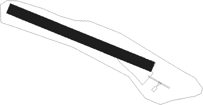
Runway info
| Runway 11 / 29 | ||
| length | 525m (1722ft) | |
| bearing | 107° / 287° | |
| width | 36m (119ft) | |
| surface | grass | |
Nearby beacons
| code | identifier | dist | bearing | frequency |
|---|---|---|---|---|
| FTZ | FRITZLAR NDB | 18.9 | 270° | 468 |
| DKS | DME-ILS | 27.8 | 303° | 111.50 |
| FUL | FULDA VOR/DME | 32.4 | 215° | 112.10 |
| WRB | WARBURG VOR/DME | 39.4 | 297° | 113.70 |
| GED | GEDERN VORTAC | 47.8 | 225° | 110.80 |
Disclaimer
The information on this website is not for real aviation. Use this data with the X-Plane flight simulator only! Data taken with kind consent from X-Plane 12 source code and data files. Content is subject to change without notice.