Esslingen - Esslingen-jaegerhaus
Airport details
| Country | Germany |
| State | Baden-Württemberg |
| Region | |
| Airspace | Langen Ctr |
| Municipality | Esslingen am Neckar |
| Elevation | 1604ft (489m) |
| Timezone | GMT +1 |
| Coordinates | 48.76400, 9.32989 |
| Magnetic var | |
| Type | land |
| Available since | X-Plane v10.40 |
| ICAO code | XEDBU |
| IATA code | n/a |
| FAA code | n/a |
Communication
| Esslingen-Jaegerhaus Tower | 118.165 |
Nearby Points of Interest:
Becelaere-Kaserne
-Mülbergerstraße 180 (Esslingen)
-Glockenkelter
-Landolinshof
-Neuer Jüdischer Friedhof
-Glasdachfabrik Eberspächer
-Augustinerstraße 8
-Zwerchstraße 6
-Webergasse 18
-Augustinerstraße 5 (Esslingen)
-Augustinerstraße 22 (Esslingen)
-Landolinsgasse 8/1
-Dekanatsgebäude (Esslingen)
-Bebenhäuser Pfleghof
-Hafenmarkt 7
-Neues Rathaus Esslingen
-Katharinenhospital Esslingen
-Astronomische Uhr, Rathaus, Esslingen
-Altes Rathaus
-Allerheiligenkapelle
-Abt-Fulrad-Straße 3
-Entengrabenstraße 2
-Mettinger Straße 19
-Haus Obertorstraße 21/23
-Alte Feuerwache (Esslingen)
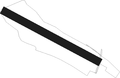
Runway info
| Runway 13 / 31 | ||
| length | 702m (2303ft) | |
| bearing | 113° / 293° | |
| width | 52m (170ft) | |
| surface | grass | |
Nearby beacons
| code | identifier | dist | bearing | frequency |
|---|---|---|---|---|
| STG | STUTTGART VOR/DME | 4.9 | 227° | 116.85 |
| SGD | DME | 6.1 | 234° | 115.45 |
| LBU | LUBURG VOR/DME | 8.9 | 4° | 109.20 |
| TGO | TANGO TACAN | 9.1 | 206° | 112.50 |
| SHD | HALL DME | 27.5 | 52° | 108.05 |
| KRH | KARLSRUHE VOR/DME | 32.5 | 287° | 115.95 |
| SUL | SULZ VOR | 35.6 | 241° | 116.10 |
| LUP | LAUPHEIM NDB | 40.1 | 133° | 407 |
| NKR | NECKAR NDB | 41.6 | 314° | 292 |
| DKB | DINKELSBUEHL VORTAC | 42.4 | 67° | 117.80 |
| NDD | DME-ILS | 45.2 | 45° | 108.70 |
| NSN | NIEDERSTETTEN NDB | 45.3 | 45° | 311 |
| MND | DME | 53.1 | 311° | 113.55 |
| ALD | (MEMMINGEN/ALLGAU) DME | 58.8 | 131° | 117.20 |
| ALG | ALLGAEU (MEMMINGEN) NDB | 59.1 | 129° | 341 |
Disclaimer
The information on this website is not for real aviation. Use this data with the X-Plane flight simulator only! Data taken with kind consent from X-Plane 12 source code and data files. Content is subject to change without notice.