Hilzingen
Airport details
| Country | Germany |
| State | Baden-Württemberg |
| Region | |
| Airspace | Switzerland Ctr |
| Municipality | Hilzingen |
| Elevation | 1484ft (452m) |
| Timezone | GMT +1 |
| Coordinates | 47.75956, 8.77320 |
| Magnetic var | |
| Type | land |
| Available since | X-Plane v10.40 |
| ICAO code | XEDC0 |
| IATA code | n/a |
| FAA code | n/a |
Communication
| Hilzingen Hilzingen Info | 127.140 |
Nearby Points of Interest:
St. Peter und Paul
-Jüdischer Friedhof Randegg
-house to the Hirzen
-Weier, neolithic shore settlement
-Jüdischer Friedhof
-Burg Unterhof
-Haus zum Goldenen Leuen
-Diessenhofen
-Katholisches Pfarrhaus Engen
-Hemishofen rhine bridge
-Klosterkirche St. Michael
-Eisenbibliothek
-Konzernarchiv der Georg Fischer AG
-Rheinbrücke Feuerthalen
-Schweizerhof
-Bachschulhaus
-Ehemaliges Benediktinerpriorat Wagenhausen
-Werksiedlung Stahlwerkstrasse
-Ochseschüür
-Giesserei +GF+, Werk I
-Kloster Allerheiligen Schaffhausen
-Kaufleutstube (Schaffhausen)
-Haus zum Ritter
-Hallen für Neue Kunst
-Grosses Haus
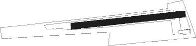
Runway info
| Runway 08 / 26 | ||
| length | 608m (1995ft) | |
| bearing | 89° / 269° | |
| width | 35m (115ft) | |
| surface | grass | |
Nearby beacons
| code | identifier | dist | bearing | frequency |
|---|---|---|---|---|
| ZUE | ZURICH EAST VOR/DME | 10.2 | 165° | 110.05 |
| TRA | DME | 14.2 | 258° | 114.30 |
| KLO | KLOTEN (ZURICH) VOR/DME | 20.3 | 217° | 114.85 |
| FHD | DME | 30 | 97° | 112.60 |
| SUL | SULZ VOR | 37.7 | 348° | 116.10 |
| WIL | WILLISAU VOR/DME | 49.5 | 236° | 116.90 |
| LHR | LAHR NDB | 52.3 | 301° | 337 |
| LRD | DME | 52.5 | 303° | 108.05 |
| TGO | TANGO TACAN | 55.1 | 30° | 112.50 |
| SGD | DME | 58.6 | 26° | 115.45 |
| STG | STUTTGART VOR/DME | 59.4 | 27° | 116.85 |
Disclaimer
The information on this website is not for real aviation. Use this data with the X-Plane flight simulator only! Data taken with kind consent from X-Plane 12 source code and data files. Content is subject to change without notice.