Wehr - Huetten Hotzenwald
Airport details
| Country | Germany |
| State | Baden-Württemberg |
| Region | |
| Airspace | Switzerland Ctr |
| Municipality | Rickenbach |
| Elevation | 2862ft (872m) |
| Timezone | GMT +1 |
| Coordinates | 47.63317, 7.94199 |
| Magnetic var | |
| Type | land |
| Available since | X-Plane v10.40 |
| ICAO code | XEDC7 |
| IATA code | n/a |
| FAA code | n/a |
Communication
| Huetten Hotzenwald Info Huetten/Hotzenwald | 125.815 |
Nearby Points of Interest:
Altes Schloss Wehr
-Fahrgraben, Teil der spätrömischen Rheinbefestigung
-Sebastian chapel
-Riburg «Bürkli», part of the late Roman Rhine fortification and early medieval fortification
-Bata Park
-Schlosskirche Beuggen
-christ catholic rectory
-Laufenburg
-catholic parish church
-christ catholic church of St. George
-christ catholic parish church
-rectory
-roman catholic church of St. George
-former Johanniterkommende
-Maisprach
-Rheinfelden
-Flaig-House
-city hall
-former Gasthof zum goldenen Adler
-Stadtbefestigung (Stadtmauer mit -graben, Obertorturm, Kupfer-/Storchennestturm, Messer-/Diebsturm)
-Zum Lustgarten house
-schoolhouse Hugenfeld
-St. Peter
-Schloss Steinen
-Hagenbacher Hof
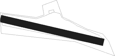
Runway info
| Runway 10 / 28 | ||
| length | 707m (2320ft) | |
| bearing | 102° / 282° | |
| width | 50m (164ft) | |
| surface | grass | |
Nearby beacons
| code | identifier | dist | bearing | frequency |
|---|---|---|---|---|
| HOC | DME | 15 | 239° | 113.20 |
| BS | BASLE-MULHOUSE NDB | 16.7 | 262° | 376 |
| BLM | BASLE-MULHOUSE VOR/DME | 17.9 | 270° | 117.45 |
| BN | BASLE-MULHOUSE NDB | 18.8 | 274° | 353 |
| TRA | DME | 20.3 | 84° | 114.30 |
| KLO | KLOTEN (ZURICH) VOR/DME | 26.6 | 106° | 114.85 |
| WIL | WILLISAU VOR/DME | 27.3 | 185° | 116.90 |
| GRE | GRENCHEN VOR/DME | 34.4 | 229° | 115.45 |
| ZUE | ZURICH EAST VOR/DME | 35.5 | 93° | 110.05 |
| HO | COLMAR-HOUSSEN NDB | 37.9 | 311° | 380 |
| LHR | LAHR NDB | 43.2 | 350° | 337 |
| LRD | DME | 44.1 | 351° | 108.05 |
| SUL | SULZ VOR | 53 | 43° | 116.10 |
| STR | STRASBOURG ENTZHEIM VOR/DME | 54.4 | 337° | 115.60 |
| SE | STRASBOURG NDB | 58.1 | 347° | 412 |
| FRI | FRIBOURG VOR/DME | 59.1 | 220° | 110.85 |
Disclaimer
The information on this website is not for real aviation. Use this data with the X-Plane flight simulator only! Data taken with kind consent from X-Plane 12 source code and data files. Content is subject to change without notice.