Gaißach - Greiling
Airport details
| Country | Germany |
| State | Bavaria |
| Region | |
| Airspace | Munich Ctr |
| Municipality | Greiling |
| Elevation | 2352ft (717m) |
| Timezone | GMT +1 |
| Coordinates | 47.76018, 11.59060 |
| Magnetic var | |
| Type | land |
| Available since | X-Plane v10.40 |
| ICAO code | XEDCB |
| IATA code | n/a |
| FAA code | n/a |
Communication
| Greiling Greiling Info | 128.840 |
Nearby Points of Interest:
Kloster Tölz
-Kapelle Unserer Lieben Frau
-Kaltenbachquelle im Kirchsee-Filz
-Schloss Hechenberg
-Turmhügel Hechenberg
-Rathaus Lenggries
-Burg Ebertshausen
-St. Laurentius (Königsdorf)
-Ehemals Kleinbauernhaus
-St. Michael
-Pfarrhaus
-Seppenhof
-landgasthof - hotel reindlschmiede
-Gasthof
-Amtsgericht
-Rathaus Tegernsee
-Kapelle Schönmühl
-Asamstraße 28 (Benediktbeuern)
-Gasthof zur Post
-Bahnhofstraße 26 (Benediktbeuern)
-Christkönig-Kirche (Penzberg)
-Schloss Beuerberg
-Altenheim (Penzberg)
-Günderer 1 (Weyarn)
-Kloster Weyarn
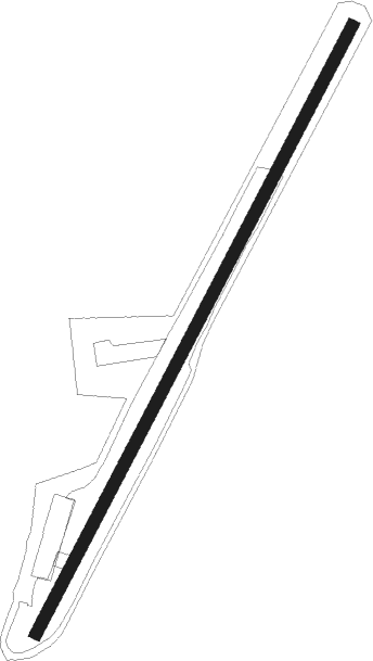
Runway info
| Runway 03 / 21 | ||
| length | 1345m (4413ft) | |
| bearing | 43° / 223° | |
| width | 23m (77ft) | |
| surface | grass | |
Nearby beacons
| code | identifier | dist | bearing | frequency |
|---|---|---|---|---|
| OBI | OBERPFAFFENHOFEN NDB | 22.8 | 316° | 429 |
| RTT | RATTENBERG NDB | 24.3 | 133° | 303 |
| OTT | OTTERSBERG VOR/DME | 26.8 | 28° | 112.30 |
| RUM | RUM NDB | 29.5 | 195° | 320 |
| MAH | MAISACH VOR/DME | 32.2 | 331° | 115.20 |
| INN | INNSBRUCK NDB | 32.7 | 200° | 420 |
| PAT | DME | 33.5 | 193° | 112 |
| MSE | MUNICH NDB | 34.5 | 6° | 358 |
| DMS | DME | 35.6 | 18° | 115 |
| MNE | MUNICH NDB | 35.9 | 8° | 369 |
| DMN | DME | 37.3 | 19° | 116 |
| MSW | MUNICH NDB | 37.7 | 28° | 400 |
| MNW | MUNICH NDB | 39 | 28° | 338 |
| LCH | LECHFELD TACAN | 39.1 | 300° | 108.80 |
| AUG | DME | 47.7 | 316° | 115.90 |
| AGB | AUGSBURG NDB | 47.8 | 315° | 318 |
| MIQ | MIKE NDB | 48.6 | 0° | 426 |
| WLD | WALDA VOR/DME | 52.5 | 331° | 112.80 |
| IGL | INGOLSTADT TACAN | 57.5 | 359° | 111.40 |
| IGL | INGOLSTADT NDB | 58.7 | 3° | 345 |
| NEU | NEUBURG TACAN | 59.1 | 338° | 108.90 |
Disclaimer
The information on this website is not for real aviation. Use this data with the X-Plane flight simulator only! Data taken with kind consent from X-Plane 12 source code and data files. Content is subject to change without notice.