Haiterbach - Haiterbach-nagold
Airport details
| Country | Germany |
| State | Baden-Württemberg |
| Region | |
| Airspace | Langen Ctr |
| Municipality | Haiterbach |
| Elevation | 1952ft (595m) |
| Timezone | GMT +1 |
| Coordinates | 48.53011, 8.67036 |
| Magnetic var | |
| Type | land |
| Available since | X-Plane v10.40 |
| ICAO code | XEDCJ |
| IATA code | n/a |
| FAA code | n/a |
Communication
| Haiterbach-Nagold Haiterbach-Nagold | 134.990 |
Nearby Points of Interest:
Wasserkraftwerk Nagold
-Aufbaugymnasium Nagold
-Spitalkirche Herrenberg
-Gasthaus Rössle (Trillfingen)
-Karmelitenkloster Rottenburg
-St. Moriz
-Category:St Anna Church (Haigerloch)
-Schloss Gärtringen
-Burg Rohrau
-Gartenhalle
-Kornhaus
-Thiepval-Kaserne
-Schwabenhaus
-Friedhofkirche Balingen
-Stadtkirche Balingen
-Marktbrunnen (Balingen)
-Viehmarktplatz 8
-Stadtbefestigung Balingen
-Spital (Balingen)
-Schwedenschanze
-St. Ulrich (Thanheim)
-Herrenalb Abbey
-Hölzersee
-Jakobskirche Gernsbach
-Denkmal für die Gefallenen des Ersten Weltkriegs
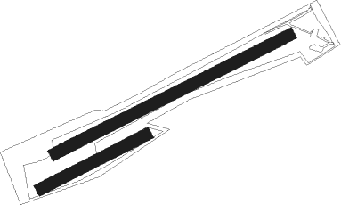
Runway info
Runway 07 / 25  | ||
| length | 858m (2815ft) | |
| bearing | 75° / 255° | |
| width | 38m (126ft) | |
| surface | grass | |
| Runway 06 / 24 | ||
| length | 383m (1257ft) | |
| bearing | 75° / 255° | |
| width | 38m (126ft) | |
| surface | grass | |
Nearby beacons
| code | identifier | dist | bearing | frequency |
|---|---|---|---|---|
| SUL | SULZ VOR | 8.9 | 190° | 116.10 |
| SGD | DME | 23.9 | 74° | 115.45 |
| TGO | TANGO TACAN | 23.9 | 81° | 112.50 |
| STG | STUTTGART VOR/DME | 25.3 | 74° | 116.85 |
| KBD | DME | 27.5 | 293° | 115.80 |
| KBA | KARLSRUHE/BADEN-BADEN NDB | 27.8 | 295° | 431 |
| KRH | KARLSRUHE VOR/DME | 28 | 349° | 115.95 |
| LRD | DME | 35 | 259° | 108.05 |
| LBU | LUBURG VOR/DME | 35.1 | 60° | 109.20 |
| LHR | LAHR NDB | 35.9 | 258° | 337 |
| SE | STRASBOURG NDB | 38.1 | 274° | 412 |
| NKR | NECKAR NDB | 48.5 | 4° | 292 |
| TRA | DME | 51.3 | 196° | 114.30 |
| ZUE | ZURICH EAST VOR/DME | 56.6 | 171° | 110.05 |
| MND | DME | 56.8 | 351° | 113.55 |
| FHD | DME | 61.6 | 136° | 112.60 |
Disclaimer
The information on this website is not for real aviation. Use this data with the X-Plane flight simulator only! Data taken with kind consent from X-Plane 12 source code and data files. Content is subject to change without notice.