Mühlacker - Hangensteiner Hof
Airport details
| Country | Germany |
| State | Baden-Württemberg |
| Region | |
| Airspace | Langen Ctr |
| Municipality | Mühlacker |
| Elevation | 966ft (294m) |
| Timezone | GMT +1 |
| Coordinates | 48.93167, 8.81245 |
| Magnetic var | |
| Type | land |
| Available since | X-Plane v10.40 |
| ICAO code | XEDCM |
| IATA code | n/a |
| FAA code | n/a |
Communication
| Hangensteiner Hof Hangenstein Info | 128.840 |
Nearby Points of Interest:
Evangelisches Gemeindehaus
-Albanikirche
-Posthof Illingen
-Ehemaliges Bezirksamt, Bahnhofstraße 22–26, Pforzheim
-Industriehaus Pforzheim
-Kollmar & Jourdan House
-Jüdischer Friedhof Bretten
-Schafscheuer (Oberderdingen)
-Obere Gasse 16
-Brettener Straße 39 (Oberderdingen)
-Obere Gasse 15
-Wallfahrtskirche Johannes der Täufer
-Hintere Gasse 28 (Oberderdingen)
-Brettener Straße 27 (Oberderdingen)
-Gasthaus Sonne
-Brettener Straße 25 (Oberderdingen)
-Hegelweg 1
-Große Kelter
-Gaisrain 58 (Kürnbach)
-Löwengasse 8 (Kürnbach)
-Altes Rathaus (Wössingen)
-Fränkisches Gehöft (Wössingen)
-Alte Synagoge
-Schloss Großsachsenheim
-Pfarrhaus
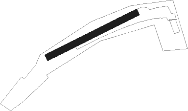
Runway info
| Runway 06 / 24 | ||
| length | 507m (1663ft) | |
| bearing | 75° / 255° | |
| width | 35m (114ft) | |
| surface | grass | |
Nearby beacons
| code | identifier | dist | bearing | frequency |
|---|---|---|---|---|
| KRH | KARLSRUHE VOR/DME | 9.7 | 285° | 115.95 |
| LBU | LUBURG VOR/DME | 20.8 | 92° | 109.20 |
| SGD | DME | 21.8 | 121° | 115.45 |
| STG | STUTTGART VOR/DME | 22.5 | 118° | 116.85 |
| NKR | NECKAR NDB | 24.5 | 349° | 292 |
| TGO | TANGO TACAN | 25.8 | 125° | 112.50 |
| KBA | KARLSRUHE/BADEN-BADEN NDB | 29.3 | 259° | 431 |
| KBD | DME | 30 | 258° | 115.80 |
| SUL | SULZ VOR | 33.6 | 197° | 116.10 |
| MND | DME | 34.3 | 331° | 113.55 |
| SHD | HALL DME | 39.6 | 79° | 108.05 |
| LRD | DME | 51.8 | 240° | 108.05 |
| RID | RIED VOR/DME | 52.1 | 342° | 112.20 |
| CHA | CHARLIE VOR/DME | 60 | 13° | 115.35 |
Disclaimer
The information on this website is not for real aviation. Use this data with the X-Plane flight simulator only! Data taken with kind consent from X-Plane 12 source code and data files. Content is subject to change without notice.