Halle - Hellenhagen
Airport details
| Country | Germany |
| State | Lower Saxony |
| Region | |
| Airspace | Bremen Ctr |
| Municipality | Halle |
| Elevation | 653ft (199m) |
| Timezone | GMT +1 |
| Coordinates | 52.02699, 9.56154 |
| Magnetic var | |
| Type | land |
| Available since | X-Plane v10.40 |
| ICAO code | XEDCR |
| IATA code | n/a |
| FAA code | n/a |
Communication
| Hellenhagen Hellenhagen START | 128.755 |
Nearby Points of Interest:
Rittergut Voldagsen
-Hajener Hungerstein
-St. Jakobus (Eime)
-Schloss Hasperde
-St. Vinzenz
-Osterstraße 12
-St.-Annen-Kirche
-Hinter der Burg 1
-Hünenburg
-Kapelle auf dem Alten Friedhof
-Rittergut Bockerode
-Bahnhofstraße 50 (Springe)
-Ringwall der Marienburg bei Nordstemmen
-jewish cemetery
-Rittergut Bennigsen
-Kalkwerk Bredenbeck
-St. Magnuskirche
-St. Georg
-Kirche Mariä Geburt
-Antoniuskirche
-Alte Schule
-Wasserburg Bredenbeck
-Lavesmühle
-St. Laurentius
-Untere Mühle Bredenbeck
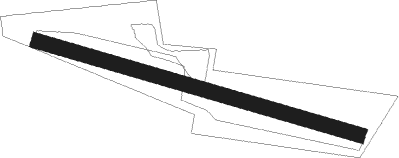
Runway info
| Runway 11 / 29 | ||
| length | 558m (1831ft) | |
| bearing | 103° / 283° | |
| width | 26m (84ft) | |
| surface | grass | |
Nearby beacons
| code | identifier | dist | bearing | frequency |
|---|---|---|---|---|
| DLE | LEINE VOR/DME | 17.9 | 55° | 115.20 |
| SAS | SARSTEDT VOR/DME | 17.9 | 55° | 114.45 |
| BYC | BUECKEBURG NDB | 23.4 | 299° | 368 |
| HBD | DME | 25.9 | 13° | 116.90 |
| WUN | WUNSTORF TACAN | 26.1 | 343° | 114.85 |
| HW | HANNOVER NDB | 26.5 | 358° | 358 |
| HAD | DME | 26.9 | 17° | 113.95 |
| HA | HANNOVER NDB | 27.7 | 29° | 320 |
| WRB | WARBURG VOR/DME | 35.5 | 221° | 113.70 |
| NIE | NIENBURG VOR | 36.6 | 342° | 116.50 |
| DKS | DME-ILS | 36.8 | 194° | 111.50 |
| CEL | CELLE NDB | 37.9 | 40° | 311 |
| PAD | PADERBORN-LIPPSTADT NDB | 41.9 | 246° | 354 |
| PAD | DME-ILS | 43 | 246° | 108.50 |
| FTZ | FRITZLAR NDB | 56.8 | 189° | 468 |
| FSB | FASSBERG NDB | 58 | 35° | 284 |
Disclaimer
The information on this website is not for real aviation. Use this data with the X-Plane flight simulator only! Data taken with kind consent from X-Plane 12 source code and data files. Content is subject to change without notice.