Hersbruck
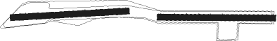
Airport details
| Country | Germany |
| State | Bavaria |
| Region | |
| Airspace | Munich Ctr |
| Municipality | Hersbruck |
| Elevation | 1107ft (337m) |
| Timezone | GMT +1 |
| Coordinates | 49.50758, 11.44047 |
| Magnetic var | |
| Type | land |
| Available since | X-Plane v10.40 |
| ICAO code | XEDCW |
| IATA code | n/a |
| FAA code | n/a |
Communication
| Hersbruck Hersbruck Info | 122.050 |
Nearby Points of Interest:
Hersbruck (links Pegnitz) station
-Turmhügel Hundsdruck
-Burgruine Lichtenstein in Pommelsbrunn
-Landschaftsgarten in Pommelsbrunn
-Burgruine in Happurg
-Kloster Engelthal
-Steinkreuz in Engelthal
-Ehemaliges Wohnstallhaus in Engelthal
-Teufelskanzel bei Mittelburg
-Ehem. Synagoge in Ottensoos
-Turmhügel Purkstal
-Turmhügel Egensbach
-Burgstall Hohenkuchen
-Marderloch
-Hammerschloss Hirschbach
-Friedhof in Schnaittach
-Steinerne Rinne bei Raschbach
-Uhrturm in Rupprechtstegen
-Eratsmühle
-Burgstall Werdenstein
-Burgstall auf der Hasenleite
-Burgstall Hienberg
-Altes Gemeindehaus in Leinburg
-Burg Neidstein
-Pfarrhaus in Fürnried

Nearby beacons
| code | identifier | dist | bearing | frequency |
|---|---|---|---|---|
| RTB | ROETHENBACH NDB | 7.4 | 262° | 415 |
| NGD | DME | 14 | 269° | 113.10 |
| ERL | ERLANGEN VOR/DME | 14.3 | 297° | 114.90 |
| NUB | NUERNBERG VOR/DME | 15.8 | 269° | 115.75 |
| GRF | GRAFENWOHR TACAN | 22.2 | 70° | 111.80 |
| GRW | GRAFENWOHR NDB | 22.5 | 70° | 405 |
| HFX | HOHENFELS NDB | 23.8 | 125° | 286 |
| BAY | BAYREUTH VOR | 29.6 | 22° | 110.60 |
| ANS | ANSBACH NDB | 33.7 | 256° | 452 |
| IGL | INGOLSTADT NDB | 46.9 | 165° | 345 |
| IGL | INGOLSTADT TACAN | 47.6 | 171° | 111.40 |
| NEU | NEUBURG TACAN | 48.5 | 196° | 108.90 |
| OKG | CHEB VOR/DME | 50.2 | 60° | 115.70 |
| MIQ | MIKE NDB | 56.6 | 170° | 426 |
| WLD | WALDA VOR/DME | 57 | 199° | 112.80 |
Disclaimer
The information on this website is not for real aviation. Use this data with the X-Plane flight simulator only! Data taken with kind consent from X-Plane 12 source code and data files. Content is subject to change without notice.