Schifferstadt - Ludwigshafen-dannstadt
Airport details
| Country | Germany |
| State | Rhineland-Palatinate |
| Region | |
| Airspace | Langen Ctr |
| Municipality | Dannstadt-Schauernheim |
| Elevation | 313ft (95m) |
| Timezone | GMT +1 |
| Coordinates | 49.40811, 8.34413 |
| Magnetic var | |
| Type | land |
| Available since | X-Plane v11.55 |
| ICAO code | XEDD3 |
| IATA code | n/a |
| FAA code | n/a |
Communication
| Ludwigshafen-Dannstadt Dannstadt | 123.965 |
Nearby Points of Interest:
Schlösschen im Park
-Altes Rathaus Mutterstadt
-St. Peter
-Pfarrhaus
-Protestantische Kirche Friedelsheim
-St.-Gallus-Kirche
-Weingut Josef Biffar
-tea pavilion
-Dreifaltigkeitskirche
-Weinstraße 5
-Weinstraße 29
-Weinstraße 40
-Weinstraße 21
-Weinstraße 32 (Deidesheim)
-Beinhaus
-Weingut Mehling
-Heumarktstraße
-Weinstraße 60 (Deidesheim)
-Villa Kirrmeier-Ecarius
-Altes Zollhäuschen
-Wasserturm
-Ketschauer Hof
-Friedrich-Engelhorn-Hochhaus
-Amtsgericht Speyer
-Jagdschloss Lambsheim
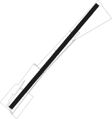
Runway info
| Runway 05 / 23 | ||
| length | 1050m (3445ft) | |
| bearing | 57° / 237° | |
| width | 33m (107ft) | |
| surface | grass | |
Nearby beacons
| code | identifier | dist | bearing | frequency |
|---|---|---|---|---|
| MND | DME | 7.6 | 70° | 113.55 |
| NKR | NECKAR NDB | 15.7 | 100° | 292 |
| RID | RIED VOR/DME | 23.7 | 28° | 112.20 |
| KRH | KARLSRUHE VOR/DME | 26.6 | 150° | 115.95 |
| RMS | RAMSTEIN TACAN | 29.6 | 272° | 113.40 |
| VFM | NAUHEIM VOR | 33.6 | 13° | 113.75 |
| FW | FRANKFURT NDB | 35.9 | 8° | 382 |
| ZWN | ZWEIBRUECKEN VOR/DME | 37.8 | 259° | 114.80 |
| KBA | KARLSRUHE/BADEN-BADEN NDB | 37.9 | 202° | 431 |
| FRD | DME | 38.3 | 20° | 115.90 |
| WIB | WIESBADEN TACAN | 38.3 | 357° | 114.10 |
| KBD | DME | 39 | 202° | 115.80 |
| FFM | FRANKFURT VORTAC | 40.4 | 24° | 114.20 |
| CHA | CHARLIE VOR/DME | 40.9 | 54° | 115.35 |
| FR | FRANKFURT NDB | 41.6 | 27° | 297 |
| LBU | LUBURG VOR/DME | 49.1 | 116° | 109.20 |
| SAV | SAVERNE VOR/DME | 50.9 | 236° | 110.45 |
| TAU | TAUNUS VOR/DME | 51 | 348° | 113.35 |
| SE | STRASBOURG NDB | 55 | 218° | 412 |
| SGD | DME | 55.4 | 129° | 115.45 |
| MTR | METRO VOR | 55.6 | 30° | 110 |
| STG | STUTTGART VOR/DME | 55.8 | 128° | 116.85 |
| TGO | TANGO TACAN | 59.5 | 131° | 112.50 |
| STR | STRASBOURG ENTZHEIM VOR/DME | 62.1 | 221° | 115.60 |
Disclaimer
The information on this website is not for real aviation. Use this data with the X-Plane flight simulator only! Data taken with kind consent from X-Plane 12 source code and data files. Content is subject to change without notice.