Heiligenhaus - Flugplatz Meiersberg
Airport details
| Country | Germany |
| State | North Rhine-Westphalia |
| Region | |
| Airspace | Langen Ctr |
| Municipality | Heiligenhaus |
| Elevation | 484ft (148m) |
| Timezone | GMT +1 |
| Coordinates | 51.30100, 6.95400 |
| Magnetic var | |
| Type | land |
| Available since | X-Plane v10.40 |
| ICAO code | XEDD9 |
| IATA code | n/a |
| FAA code | n/a |
Communication
Nearby Points of Interest:
Haus Anger
-manor Rommeljans
-Papierfabrik Bagel
-Amtsgericht Mettmann
-Textilfabrik Cromford
-Kain-und-Abel-Kamin
-Troja-Kamin
-Amtsgericht Ratingen
-Haus Schöller
-Tillmannsdorfer Sattel
-Haus Bavier
-Stift Gerresheim
-Gut Steinberg
-Villa Bayer, Erkrath
-Werden Abbey
-Tesch-Tunnel
-Haus Heck
-Meistersiedlung
-Lapis-Saal
-Rathaus Wuppertal-Vohwinkel
-Bruch schwebebahn station
-Bahnhof Wuppertal-Varresbeck
-Gräfrather Straße 15 (Wuppertal)
-Hof Beek
-Haus Neiser
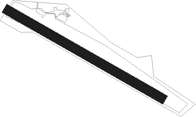
Runway info
| Runway 12 / 30 | ||
| length | 801m (2628ft) | |
| bearing | 113° / 293° | |
| width | 44m (144ft) | |
| surface | grass | |
Nearby beacons
| code | identifier | dist | bearing | frequency |
|---|---|---|---|---|
| LI | DUESSELDORF NDB | 3.6 | 306° | 417 |
| DUS | DUESSELDORF VOR/DME | 7.5 | 265° | 115.15 |
| BAM | BARMEN VOR/DME | 8.5 | 83° | 114 |
| DY | DUESSELDORF NDB | 11.9 | 257° | 284 |
| BOT | BOTTROP NDB | 17.2 | 14° | 406 |
| MHD | DME | 17.8 | 262° | 112.50 |
| MHV | MOENCHENGLADBACH VOR | 17.8 | 262° | 109.80 |
| WYP | WIPPER VOR | 19.5 | 128° | 109.60 |
| LMA | LIMA NDB | 21.3 | 277° | 311 |
| LJ | COLOGNE-BONN NDB | 22.8 | 164° | 365 |
| LW | COLOGNE-BONN NDB | 26.6 | 143° | 300 |
| KBO | COLOGNE-BONN VOR/DME | 27.3 | 156° | 112.15 |
| DOR | WICKEDE (DORTMUND) VOR/DME | 28.7 | 72° | 108.65 |
| DWI | DORTMUND-WICKEDE NDB | 28.8 | 72° | 357 |
| WNN | DME | 29.9 | 211° | 109.85 |
| NVO | NOERVENICH VORTAC | 31.1 | 214° | 116.20 |
| LV | COLOGNE-BONN NDB | 31.7 | 150° | 327 |
| LAA | NIEDERRHEIN NDB | 34.3 | 291° | 352 |
| NID | DME | 35.3 | 290° | 115.50 |
| GMH | GERMINGHAUSEN VOR/DME | 36.1 | 98° | 115.40 |
| COL | COLA VOR/DME | 39.3 | 129° | 108.80 |
| GIX | GEILENKIRCHEN TACAN | 39.8 | 250° | 108.10 |
| MAS | MAASTRICHT VOR/DME | 42.3 | 252° | 108.60 |
| HMM | HAMM VOR/DME | 43.6 | 54° | 115.65 |
| RKN | DME | 50.4 | 347° | 116.80 |
| MOD | DME | 57.1 | 41° | 114.05 |
| MYN | MUENSTER/OSNABRUECK NDB | 60.3 | 45° | 371 |
Disclaimer
The information on this website is not for real aviation. Use this data with the X-Plane flight simulator only! Data taken with kind consent from X-Plane 12 source code and data files. Content is subject to change without notice.