Isny - Isny-rotmoos
Airport details
| Country | Germany |
| State | Baden-Württemberg |
| Region | |
| Airspace | Munich Ctr |
| Municipality | Isny im Allgäu |
| Elevation | 2247ft (685m) |
| Timezone | GMT +1 |
| Coordinates | 47.70589, 10.01858 |
| Magnetic var | |
| Type | land |
| Available since | X-Plane v10.40 |
| ICAO code | XEDDB |
| IATA code | n/a |
| FAA code | n/a |
Communication
Nearby Points of Interest:
St. George's Abbey
-Pfarrkirche St. Maria (Isny)
-Pfarrhaus
-rectory
-Kapelle
-Franziskanerinnenkloster Leutkirch im Allgäu
-Findling östlich von Lindenberg
-Pestkapelle (Kimratshofen)
-Neues Pfarrhaus
-Rathaus Lindenberg im Allgäu
-Saint Magnus of Füssen Chapel
-Zu den sieben Zufluchten
-Marienkapelle
-Kapelle (Winnings)
-Heimatmuseum Oberstaufen
-Mariensäule
-Bauernhaus
-Aheggmühle
-Saint Michael Chapel (Diesenbach, Altusried)
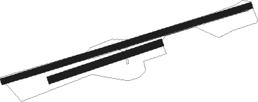
Runway info
Runway 06 / 24  | ||
| length | 1019m (3343ft) | |
| bearing | 81° / 261° | |
| width | 25m (82ft) | |
| surface | grass | |
| Runway 07 / 25 | ||
| length | 452m (1483ft) | |
| bearing | 80° / 260° | |
| width | 30m (98ft) | |
| surface | grass | |
Nearby beacons
| code | identifier | dist | bearing | frequency |
|---|---|---|---|---|
| KPT | KEMPTEN VOR/DME | 13.5 | 83° | 108.40 |
| ALD | (MEMMINGEN/ALLGAU) DME | 19 | 37° | 117.20 |
| ALG | ALLGAEU (MEMMINGEN) NDB | 20 | 40° | 341 |
| FHD | DME | 20.8 | 266° | 112.60 |
| LUP | LAUPHEIM NDB | 31 | 348° | 407 |
| LCH | LECHFELD TACAN | 44.6 | 60° | 108.80 |
| WFJ | DME | 53.1 | 194° | 113.75 |
| AGB | AUGSBURG NDB | 56.6 | 52° | 318 |
| AUG | DME | 56.8 | 52° | 115.90 |
| TGO | TANGO TACAN | 62.6 | 320° | 112.50 |
| STG | STUTTGART VOR/DME | 66.8 | 322° | 116.85 |
| SGD | DME | 67 | 321° | 115.45 |
Disclaimer
The information on this website is not for real aviation. Use this data with the X-Plane flight simulator only! Data taken with kind consent from X-Plane 12 source code and data files. Content is subject to change without notice.