Kirchzarten
Airport details
| Country | Germany |
| State | Baden-Württemberg |
| Region | |
| Airspace | Langen Ctr |
| Municipality | Kirchzarten |
| Elevation | 1340ft (408m) |
| Timezone | GMT +1 |
| Coordinates | 47.95607, 7.95576 |
| Magnetic var | |
| Type | land |
| Available since | X-Plane v10.40 |
| ICAO code | XEDDH |
| IATA code | n/a |
| FAA code | n/a |
Communication
Nearby Points of Interest:
Stadthalle Freiburg im Breisgau
-Dreikönigshaus
-Seventh-day Adventist Church in Freiburg
-Wentzingerhaus Freiburg
-Breisach's Gate
-The Whale House
-Colombischlössle Freiburg
-St. Elisabeth
-St. Märgen's Abbey
-St. Georg
-Urgraben
-Jüdischer Friedhof
-Schloss Sulzburg
-Evangelical Church
-Gare de Volgelsheim
-Bahnwärterhaus Seelenwald
-Hôtel de ville de Neuf-Brisach
-Ramparts of Neuf-Brisach
-Caserne Serano
-Place d'Armes-Général-de-Gaulle
-Arsenal de Neuf-Brisach
-caserne Suzonni
-Vicus gallo-romain de l'Oedenbourg
-Altes Schloss Wehr
-Unsere liebe Frau vom Berge Karmel
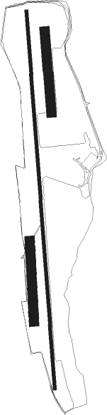
Runway info
Runway 18C / 36C  | ||
| length | 1174m (3852ft) | |
| bearing | 180° / 0° | |
| width | 10m (33ft) | |
| surface | grass | |
| Runway 18L / 36R | ||
| length | 252m (827ft) | |
| bearing | 180° / 360° | |
| width | 30m (98ft) | |
| surface | grass | |
| Runway 18R / 36L | ||
| length | 250m (820ft) | |
| bearing | 182° / 2° | |
| width | 30m (98ft) | |
| surface | grass | |
Nearby beacons
| code | identifier | dist | bearing | frequency |
|---|---|---|---|---|
| LHR | LAHR NDB | 24.2 | 340° | 337 |
| LRD | DME | 25 | 343° | 108.05 |
| TRA | DME | 25.1 | 119° | 114.30 |
| HO | COLMAR-HOUSSEN NDB | 25.9 | 287° | 380 |
| BN | BASLE-MULHOUSE NDB | 26.1 | 238° | 353 |
| BLM | BASLE-MULHOUSE VOR/DME | 26.7 | 235° | 117.45 |
| BS | BASLE-MULHOUSE NDB | 28.2 | 228° | 376 |
| HOC | DME | 31.6 | 211° | 113.20 |
| STR | STRASBOURG ENTZHEIM VOR/DME | 36.3 | 325° | 115.60 |
| SUL | SULZ VOR | 37.6 | 58° | 116.10 |
| KLO | KLOTEN (ZURICH) VOR/DME | 38.2 | 130° | 114.85 |
| SE | STRASBOURG NDB | 39.2 | 339° | 412 |
| ZUE | ZURICH EAST VOR/DME | 41 | 113° | 110.05 |
| WIL | WILLISAU VOR/DME | 46.7 | 184° | 116.90 |
| KBD | DME | 49.7 | 9° | 115.80 |
| KBA | KARLSRUHE/BADEN-BADEN NDB | 50.8 | 10° | 431 |
| GRE | GRENCHEN VOR/DME | 51.2 | 215° | 115.45 |
| SAV | SAVERNE VOR/DME | 54.3 | 329° | 110.45 |
| PHG | PHALSBOURG NDB | 57.3 | 317° | 424 |
Disclaimer
The information on this website is not for real aviation. Use this data with the X-Plane flight simulator only! Data taken with kind consent from X-Plane 12 source code and data files. Content is subject to change without notice.