Pretzier - Salzwedel Klein Gartz
Airport details
| Country | Germany |
| State | Saxony-Anhalt |
| Region | |
| Airspace | Bremen Ctr |
| Municipality | Salzwedel |
| Elevation | 109ft (33m) |
| Timezone | GMT +1 |
| Coordinates | 52.82791, 11.31611 |
| Magnetic var | |
| Type | land |
| Available since | X-Plane v10.40 |
| ICAO code | XEDDL |
| IATA code | n/a |
| FAA code | n/a |
Communication
| Salzwedel Klein Gartz Salzwedel Info | 128.800 |
Nearby Points of Interest:
Church Liesten
-Dorfkirche Kläden
-Protestant Church
-Church of Winterfeld
-Dorfkirche Dambeck (Salzwedel)
-Alte Münze (Salzwedel)
-St.-Katharinen-Kirche
-Amtsgericht Salzwedel
-Town hall in Arendsee
-Dorfkirche Zühlen
-Gustaf-Nagel-Areal
-St. Martin (Brunau)
-Dorfkirche Kuhfelde
-Dorfkirche Brüchau
-Amtsgericht Lüchow
-Feldsteinkirche Trebel
-Lokschuppen Kalbe
-Friedhof Eiskuhlenberg
-Dorfkirche Meßdorf
-Schloss
-St. Marien
-Apenburger Hof
-Saint Nicholas Church (Kalbe, Milde)
-Dorfkirche Püggen
Runway info
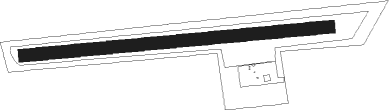
| Runway 08 / 26 | ||
| length | 777m (2549ft) | |
| bearing | 89° / 269° | |
| width | 32m (106ft) | |
| surface | grass | |
Nearby beacons
| code | identifier | dist | bearing | frequency |
|---|---|---|---|---|
| BKD | BRUENKENDORF VOR/DME | 14.9 | 48° | 117.70 |
| HLZ | HEHLINGEN VOR/DME | 33.7 | 228° | 117.30 |
| PAH | SCHWERIN-PARCHIM NDB | 36.2 | 32° | 315 |
| PMD | DME | 39.6 | 38° | 117.50 |
| BRU | BRAUNSCHWEIG-WOLFSBURG NDB | 39.9 | 235° | 427 |
| PI | SCHWERIN-PARCHIM NDB | 43.5 | 43° | 333 |
| MAG | MAGDEBURG VOR/DME | 53 | 150° | 110.45 |
| CB | COCHSTEDT NDB | 58.3 | 172° | 344 |
| LYE | LUEBECK NDB | 62.5 | 327° | 394 |
Disclaimer
The information on this website is not for real aviation. Use this data with the X-Plane flight simulator only! Data taken with kind consent from X-Plane 12 source code and data files. Content is subject to change without notice.