Impflingen - Landau- Ebenberg
Airport details
| Country | Germany |
| State | Rhineland-Palatinate |
| Region | |
| Airspace | Langen Ctr |
| Municipality | Landau in der Pfalz |
| Elevation | 530ft (162m) |
| Timezone | GMT +1 |
| Coordinates | 49.17802, 8.12315 |
| Magnetic var | |
| Type | land |
| Available since | X-Plane v10.40 |
| ICAO code | XEDDR |
| IATA code | n/a |
| FAA code | n/a |
Communication
| Landau- Ebenberg Landau Info | 128.860 |
Nearby Points of Interest:
Landgericht Landau in der Pfalz
-Hafermagazin Landau
-Jewish Cemetary (Landau)
-Queichkanal
-Rathaus Offenbach an der Queich
-Synagoge
-Institut für Rebenzüchtung Geilweilerhof
-St. Maria Himmelfahrt (Herxheim bei Landau/Pfalz)
-Stations of the Cross in Burrweiler
-Jewish cemetery, Annweiler am Trifels
-Synagoge (Venningen)
-Jewish cemetery in Edenkoben
-Synagogue (Rülzheim)
-Jagdschloss Friedrichsbühl
-Bahnhof Lustadt
-Altes Schlößchen
-Rathaus Altdorf (Pfalz)
-Weingarten Town Hall
-Evangelische Kirche Rinnthal
-Wasserturm Duttweiler
-Hellerplatzhaus
-Steinhäuser Hof
-Haidmühle
-Villa Böhm
-Burg Backelstein
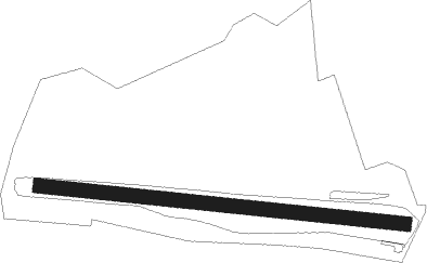
Runway info
| Runway 10 / 28 | ||
| length | 1251m (4104ft) | |
| bearing | 97° / 277° | |
| width | 50m (164ft) | |
| surface | grass | |
Nearby beacons
| code | identifier | dist | bearing | frequency |
|---|---|---|---|---|
| KRH | KARLSRUHE VOR/DME | 21.2 | 112° | 115.95 |
| KBA | KARLSRUHE/BADEN-BADEN NDB | 22.8 | 184° | 431 |
| MND | DME | 23.3 | 53° | 113.55 |
| KBD | DME | 23.9 | 185° | 115.80 |
| NKR | NECKAR NDB | 25.7 | 75° | 292 |
| RMS | RAMSTEIN TACAN | 26 | 296° | 113.40 |
| ZWN | ZWEIBRUECKEN VOR/DME | 27.8 | 274° | 114.80 |
| SAV | SAVERNE VOR/DME | 35.1 | 241° | 110.45 |
| SR | ENSHEIM (SAARBRUECKEN) NDB | 35.5 | 273° | 360 |
| SE | STRASBOURG NDB | 38.8 | 215° | 412 |
| RID | RIED VOR/DME | 39.7 | 35° | 112.20 |
| PHG | PHALSBOURG NDB | 43.9 | 246° | 424 |
| STR | STRASBOURG ENTZHEIM VOR/DME | 45.8 | 219° | 115.60 |
| VFM | NAUHEIM VOR | 48.9 | 24° | 113.75 |
| LRD | DME | 50.2 | 200° | 108.05 |
| FW | FRANKFURT NDB | 51 | 20° | 382 |
| LHR | LAHR NDB | 51.3 | 201° | 337 |
| SUL | SULZ VOR | 52 | 147° | 116.10 |
| WIB | WIESBADEN TACAN | 52.6 | 12° | 114.10 |
| FRD | DME | 54 | 28° | 115.90 |
| FFM | FRANKFURT VORTAC | 56.2 | 30° | 114.20 |
| FHH | DME | 56.8 | 312° | 117.35 |
| CHA | CHARLIE VOR/DME | 57.1 | 51° | 115.35 |
| FR | FRANKFURT NDB | 57.5 | 32° | 297 |
| HAN | HAHN NDB | 57.5 | 313° | 376 |
Disclaimer
The information on this website is not for real aviation. Use this data with the X-Plane flight simulator only! Data taken with kind consent from X-Plane 12 source code and data files. Content is subject to change without notice.