Niederaula - Langenberg
Airport details
| Country | Germany |
| State | Hesse |
| Region | |
| Airspace | Langen Ctr |
| Municipality | Niederaula |
| Elevation | 1146ft (349m) |
| Timezone | GMT +1 |
| Coordinates | 50.79412, 9.56029 |
| Magnetic var | |
| Type | land |
| Available since | X-Plane v10.40 |
| ICAO code | XEDDT |
| IATA code | n/a |
| FAA code | n/a |
Communication
| Langenberg Langenberg-Start | 133.310 |
Nearby Points of Interest:
Evangelische Kirche Schlotzau
-Town Hall of Bad Hersfeld
-Evangelische Kirche Christerode
-Bildstock (Arzell)
-Jewish cemetery, Burghaun
-Berfaer Straße 5
-St. Vitus
-Altes Burghaus Schrecksbach
-Amthof 15 (Alsfeld)
-Amtsgericht Alsfeld
-Amthof 13 (Alsfeld)
-Am Kreuz 4, 6 (Alsfeld)
-Beinhaus
-Am Kreuz 8 (Alsfeld)
-Am Kreuz 10 (Alsfeld)
-Apotheke am Rathaus
-Am Kreuz 5 (Alsfeld)
-Baugasse 6 (Alsfeld)
-Amthof 17 (Alsfeld)
-Weinhaus
-Badergasse 6 (Alsfeld)
-Amthof 10 (Alsfeld)
-Baugasse 1
-Amthof 8 (Alsfeld)
-Hochzeitshaus
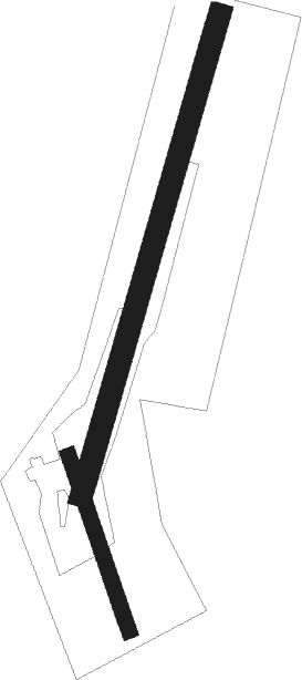
Runway info
Runway 02 / 20  | ||
| length | 783m (2569ft) | |
| bearing | 31° / 211° | |
| width | 36m (118ft) | |
| surface | grass | |
| Runway 18 / 36 | ||
| length | 289m (948ft) | |
| bearing | 158° / 338° | |
| width | 24m (80ft) | |
| surface | grass | |
Nearby beacons
| code | identifier | dist | bearing | frequency |
|---|---|---|---|---|
| FUL | FULDA VOR/DME | 12.1 | 177° | 112.10 |
| FTZ | FRITZLAR NDB | 18.2 | 333° | 468 |
| GED | GEDERN VORTAC | 25.8 | 219° | 110.80 |
| DKS | DME-ILS | 38.1 | 346° | 111.50 |
| MTR | METRO VOR | 41.2 | 234° | 110 |
| WRB | WARBURG VOR/DME | 45.9 | 328° | 113.70 |
| FR | FRANKFURT NDB | 55.1 | 230° | 297 |
| CHA | CHARLIE VOR/DME | 56 | 211° | 115.35 |
| FFM | FRANKFURT VORTAC | 56.7 | 231° | 114.20 |
| FRD | DME | 59.5 | 232° | 115.90 |
| PAD | DME-ILS | 60.4 | 311° | 108.50 |
| PAD | PADERBORN-LIPPSTADT NDB | 60.6 | 312° | 354 |
Disclaimer
The information on this website is not for real aviation. Use this data with the X-Plane flight simulator only! Data taken with kind consent from X-Plane 12 source code and data files. Content is subject to change without notice.