Leibertingen
Airport details
| Country | Germany |
| State | Baden-Württemberg |
| Region | |
| Airspace | Langen Ctr |
| Municipality | Leibertingen |
| Elevation | 2730ft (832m) |
| Timezone | GMT +1 |
| Coordinates | 48.04419, 9.02535 |
| Magnetic var | |
| Type | land |
| Available since | X-Plane v10.40 |
| ICAO code | XEDDY |
| IATA code | n/a |
| FAA code | n/a |
Communication
| Leibertingen Leibertingen Info | 121.000 |
Nearby Points of Interest:
Buchheimer Hans
-Villa rustica of Meßkirch
-Felsentäle
-Sebastianskapelle (Mühlheim an der Donau)
-Rathaus (Mühlheim an der Donau)
-Oberes Tor
-Grabenstraße 11 (Mühlheim an der Donau)
-Villa rustica of Inzigkofen
-Villa rustica of Laucherthal
-Denkmal für die Gefallenen des Ersten Weltkriegs
-Sandgrube Gertenstock
-Spital (Balingen)
-Stadtbefestigung Balingen
-Viehmarktplatz 8
-Ruin Hohenbodman
-Katholisches Pfarrhaus Engen
-Marktbrunnen (Balingen)
-Stadtkirche Balingen
-Friedhofkirche Balingen
-St. Ulrich (Thanheim)
-Kloster Heiligkreuztal
-Amtsgericht Rottweil
-Amtsgericht und Landgericht Rottweil
-Salmannsweiler Hof (Überlingen)
-Städtische Turnhalle Rottweil
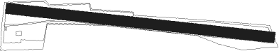
Runway info
| Runway 10 / 28 | ||
| length | 1076m (3530ft) | |
| bearing | 97° / 277° | |
| width | 42m (138ft) | |
| surface | grass | |
Nearby beacons
| code | identifier | dist | bearing | frequency |
|---|---|---|---|---|
| SUL | SULZ VOR | 25.3 | 312° | 116.10 |
| ZUE | ZURICH EAST VOR/DME | 28.4 | 205° | 110.05 |
| FHD | DME | 29.7 | 128° | 112.60 |
| TRA | DME | 31.8 | 239° | 114.30 |
| TGO | TANGO TACAN | 35.7 | 22° | 112.50 |
| LUP | LAUPHEIM NDB | 37 | 79° | 407 |
| SGD | DME | 39.4 | 17° | 115.45 |
| KLO | KLOTEN (ZURICH) VOR/DME | 40.2 | 219° | 114.85 |
| STG | STUTTGART VOR/DME | 40.2 | 20° | 116.85 |
| LBU | LUBURG VOR/DME | 53.6 | 20° | 109.20 |
| KBD | DME | 57.8 | 308° | 115.80 |
| KBA | KARLSRUHE/BADEN-BADEN NDB | 58.4 | 309° | 431 |
| KRH | KARLSRUHE VOR/DME | 59.6 | 335° | 115.95 |
Disclaimer
The information on this website is not for real aviation. Use this data with the X-Plane flight simulator only! Data taken with kind consent from X-Plane 12 source code and data files. Content is subject to change without notice.