Burghaun - Plaetzer
Airport details
| Country | Germany |
| State | Hesse |
| Region | |
| Airspace | Langen Ctr |
| Municipality | Burghaun |
| Elevation | 1115ft (340m) |
| Timezone | GMT +1 |
| Coordinates | 50.71163, 9.73751 |
| Magnetic var | |
| Type | land |
| Available since | X-Plane v10.40 |
| ICAO code | XEDE0 |
| IATA code | n/a |
| FAA code | n/a |
Communication
| Plaetzer Plaetzer | 122.205 |
Nearby Points of Interest:
Jewish cemetery, Burghaun
-Bildstock (Arzell)
-Evangelische Kirche Schlotzau
-Kriegerdenkmal Soisdorf
-St. Bernhard (Soisdorf)
-Heilig Kreuz
-Amtsgericht Geisa
-St. Georg (Ketten)
-Kath. Pfarrkirche (Schleid)
-Town Hall of Bad Hersfeld
-Richthalle Fulda
-Palais Altenstein
-Fulda
-St. Vitus
-Saint Joseph Chapel
-Propstei Johannesberg
-Jüdischer Friedhof (Vacha)
-Stadtkirche Lauterbach
-Eisenbacher Straße 1
-Am Eichberg 37
-Am Eichberg 41
-Kriegerdenkmal
-Jagdschloss Giesel
-Kloster Blankenau
-Mariä Himmelfahrt, Zella/Rhön
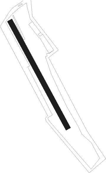
Runway info
| Runway 16 / 34 | ||
| length | 537m (1762ft) | |
| bearing | 145° / 325° | |
| width | 24m (78ft) | |
| surface | grass | |
Nearby beacons
| code | identifier | dist | bearing | frequency |
|---|---|---|---|---|
| FUL | FULDA VOR/DME | 9.5 | 234° | 112.10 |
| FTZ | FRITZLAR NDB | 25.4 | 319° | 468 |
| GED | GEDERN VORTAC | 25.9 | 238° | 110.80 |
| MTR | METRO VOR | 42.8 | 244° | 110 |
| DKS | DME-ILS | 44.4 | 335° | 111.50 |
| WRB | WARBURG VOR/DME | 53.2 | 322° | 113.70 |
| CHA | CHARLIE VOR/DME | 54.4 | 221° | 115.35 |
Disclaimer
The information on this website is not for real aviation. Use this data with the X-Plane flight simulator only! Data taken with kind consent from X-Plane 12 source code and data files. Content is subject to change without notice.