Quakenbrück - Quakenbrueck
Airport details
| Country | Germany |
| State | Lower Saxony |
| Region | |
| Airspace | Bremen Ctr |
| Municipality | Badbergen |
| Elevation | 85ft (26m) |
| Timezone | GMT +1 |
| Coordinates | 52.66335, 7.92433 |
| Magnetic var | |
| Type | land |
| Available since | X-Plane v10.40 |
| ICAO code | XEDE2 |
| IATA code | n/a |
| FAA code | n/a |
Communication
| Quakenbrueck Quakenbrueck Info | 122.630 |
Nearby Points of Interest:
St. Sylvester
-Kloster Bersenbrück
-Heeker Klause
-Giersfeld
-St. Johannes Baptist
-St. Maria Rosenkranz
-Zisterzienserinnenkloster Schale
-Ludmillenhof
-Visbeker Braut und Bräutigam
-Martin-Luther-Kirche
-Jüdischer Friedhof
-Liebfrauenkirche
-Michaelsbrunnen
-Heilig-Kreuz-Kapelle
-Meppen lock
-Sankt Johannes der Täufer, Bohmte
-Stadthaus
-Jüdischer Friedhof (Ibbenbüren)
-Herold House
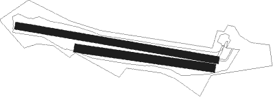
Runway info
Runway 10L / 28R  | ||
| length | 963m (3159ft) | |
| bearing | 99° / 279° | |
| width | 33m (108ft) | |
| surface | grass | |
| Runway 10R / 28L | ||
| length | 649m (2129ft) | |
| bearing | 98° / 278° | |
| width | 39m (128ft) | |
| surface | grass | |
Nearby beacons
| code | identifier | dist | bearing | frequency |
|---|---|---|---|---|
| DP | DIEPHOLZ NDB | 19.7 | 98° | 325 |
| MYN | MUENSTER/OSNABRUECK NDB | 30.6 | 194° | 371 |
| OSB | OSNABRUCK TACAN | 30.8 | 142° | 108.35 |
| OSN | OSNABRUECK VOR | 30.8 | 142° | 114.30 |
| MOD | DME | 32.7 | 204° | 114.05 |
| BMN | BREMEN VOR/DME | 38 | 65° | 117.45 |
| BND | DME | 38.6 | 66° | 113.65 |
| HIG | BREMEN NDB | 42.5 | 69° | 318 |
| HMM | HAMM VOR/DME | 49 | 195° | 115.65 |
| WSN | WESER NDB | 53.5 | 54° | 378 |
| WTM | WITTMUNDHAFEN TACAN | 53.9 | 347° | 113.50 |
Disclaimer
The information on this website is not for real aviation. Use this data with the X-Plane flight simulator only! Data taken with kind consent from X-Plane 12 source code and data files. Content is subject to change without notice.