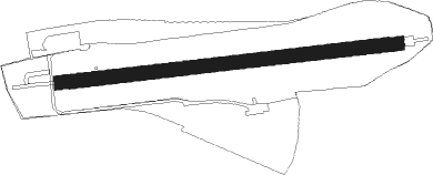
Radevormwald - Radevormwald-leye
Airport details
| Country | Germany |
| State | North Rhine-Westphalia |
| Region | |
| Airspace | Langen Ctr |
| Municipality | Radevormwald |
| Elevation | 1263ft (385m) |
| Timezone | GMT +1 |
| Coordinates | 51.21638, 7.37872 |
| Magnetic var | |
| Type | land |
| Available since | X-Plane v10.40 |
| ICAO code | XEDE3 |
| IATA code | n/a |
| FAA code | n/a |
Communication
| Radevormwald-Leye Rade INFO | 118.265 |
Runway info
| Runway 08 / 26 | ||
| length | 563m (1847ft) | |
| bearing | 89° / 269° | |
| width | 23m (75ft) | |
| surface | grass | |
Nearby beacons
| code | identifier | dist | bearing | frequency |
|---|---|---|---|---|
| BAM | BARMEN VOR/DME | 10.1 | 299° | 114 |
| WYP | WIPPER VOR | 10.7 | 210° | 109.60 |
| GMH | GERMINGHAUSEN VOR/DME | 19.5 | 95° | 115.40 |
| LW | COLOGNE-BONN NDB | 19.6 | 202° | 300 |
| LI | DUESSELDORF NDB | 19.9 | 285° | 417 |
| DOR | WICKEDE (DORTMUND) VOR/DME | 20.8 | 39° | 108.65 |
| DWI | DORTMUND-WICKEDE NDB | 20.9 | 40° | 357 |
| LJ | COLOGNE-BONN NDB | 21 | 228° | 365 |
| KBO | COLOGNE-BONN VOR/DME | 23 | 213° | 112.15 |
| DUS | DUESSELDORF VOR/DME | 23.8 | 276° | 115.15 |
| LV | COLOGNE-BONN NDB | 25.3 | 199° | 327 |
| BOT | BOTTROP NDB | 25.8 | 316° | 406 |
| COL | COLA VOR/DME | 27.2 | 154° | 108.80 |
| DY | DUESSELDORF NDB | 27.2 | 271° | 284 |
| MHD | DME | 33.3 | 271° | 112.50 |
| MHV | MOENCHENGLADBACH VOR | 33.4 | 271° | 109.80 |
| WNN | DME | 35.2 | 242° | 109.85 |
| NVO | NOERVENICH VORTAC | 36.6 | 242° | 116.20 |
| LMA | LIMA NDB | 38 | 279° | 311 |
| HMM | HAMM VOR/DME | 40.3 | 27° | 115.65 |
| SLD | DME | 40.4 | 126° | 108.05 |
| SIL | SIEGERLAND NDB | 43.1 | 125° | 489 |
| MOD | DME | 56.5 | 19° | 114.05 |
| MYN | MUENSTER/OSNABRUECK NDB | 58.7 | 24° | 371 |
| RKN | DME | 59.6 | 326° | 116.80 |
| TAU | TAUNUS VOR/DME | 65.2 | 141° | 113.35 |
| OSB | OSNABRUCK TACAN | 68 | 43° | 108.35 |
| OSN | OSNABRUECK VOR | 68 | 43° | 114.30 |
Disclaimer
The information on this website is not for real aviation. Use this data with the X-Plane flight simulator only! Data taken with kind consent from X-Plane 12 source code and data files. Content is subject to change without notice.
