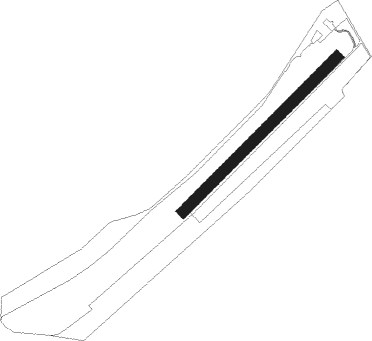
Montabauer - Montabaur
Airport details
| Country | Germany |
| State | Rhineland-Palatinate |
| Region | |
| Airspace | Langen Ctr |
| Municipality | Montabaur |
| Elevation | 855ft (261m) |
| Timezone | GMT +1 |
| Coordinates | 50.42226, 7.82692 |
| Magnetic var | |
| Type | land |
| Available since | X-Plane v10.40 |
| ICAO code | XEDEE |
| IATA code | n/a |
| FAA code | n/a |
Communication
| Montabaur Montabaur Segelflug | 131.265 |
Nearby beacons
| code | identifier | dist | bearing | frequency |
|---|---|---|---|---|
| TAU | TAUNUS VOR/DME | 16.4 | 117° | 113.35 |
| SIL | SIEGERLAND NDB | 19.5 | 50° | 489 |
| SLD | DME | 19.5 | 41° | 108.05 |
| COL | COLA VOR/DME | 23.4 | 327° | 108.80 |
| WIB | WIESBADEN TACAN | 29.2 | 128° | 114.10 |
| LV | COLOGNE-BONN NDB | 32 | 303° | 327 |
| BUE | BUECHEL TACAN | 32.5 | 252° | 117.10 |
| FW | FRANKFURT NDB | 34.1 | 125° | 382 |
| HAN | HAHN NDB | 34.5 | 230° | 376 |
| LW | COLOGNE-BONN NDB | 35.9 | 310° | 300 |
| FHH | DME | 36.1 | 230° | 117.35 |
| FRD | DME | 36.9 | 118° | 115.90 |
| KBO | COLOGNE-BONN VOR/DME | 37 | 303° | 112.15 |
| VFM | NAUHEIM VOR | 37.1 | 126° | 113.75 |
| FFM | FRANKFURT VORTAC | 38.1 | 114° | 114.20 |
| FR | FRANKFURT NDB | 39.2 | 113° | 297 |
| LJ | COLOGNE-BONN NDB | 42 | 303° | 365 |
| WYP | WIPPER VOR | 42.9 | 319° | 109.60 |
| GMH | GERMINGHAUSEN VOR/DME | 45 | 5° | 115.40 |
| RID | RIED VOR/DME | 47.3 | 132° | 112.20 |
| BAM | BARMEN VOR/DME | 59.6 | 324° | 114 |
| RMS | RAMSTEIN TACAN | 60 | 194° | 113.40 |
| MND | DME | 63 | 144° | 113.55 |
| LI | DUESSELDORF NDB | 65.8 | 315° | 417 |
Disclaimer
The information on this website is not for real aviation. Use this data with the X-Plane flight simulator only! Data taken with kind consent from X-Plane 12 source code and data files. Content is subject to change without notice.
